
30 พ.ย. ทำความรู้จักกับ Digital Twin แบบจำลองเสมือนจริงของวัตถุทางกายภาพในโลกดิจิทัล
ปัจจุบันภาครัฐและภาคอุตสาหกรรมต่างกำลังเผชิญความท้าทายและต้องปรับตัวอย่างหนักเพื่อก้าวทันเทคโนโลยีดิจิทัล และบ่อยครั้งที่การแก้ปัญหายังใช้วิธีแบบเก่าซึ่งอาจล้าหลังไปเสียแล้ว องค์กรต่าง ๆ จึงมองหาโซลูชันที่ตอบโจทย์โลกยุคใหม่ทั้งด้านเทคโนโลยีสารสนเทศ (Information Technology) และเทคโนโลยีด้านการปฏิบัติการ (Operational Technology) เพื่อพิชิตเป้าหมายแห่งการ Transformation ซึ่งจำเป็นต้องปรับวิถีการทำธุรกิจและเปลี่ยนกระบวนการทำงานเสียใหม่ และจำเป็นต้องมีโซลูชันที่สามารถปรับเปลี่ยนได้เพื่อตอบรับความท้าทายทั้งในวันนี้และสอดคล้องกับวิสัยทัศน์ขององค์กรในอนาคต ซึ่งเทคโนโลยีที่สามารถมอบโซลูชันเพื่อเป้าหมายการ Transformation ทั้งยังสอดคล้องกับวิสัยทัศน์ขององค์กร นั่นคือ เทคโนโลยีจาก ArcGIS พื้นฐานสำหรับการสร้างแบบจำลองเสมือน หรือ Digital Twin
Digital Twin คืออะไร
Digital Twin คือการสร้างแบบจำลองวัตถุทางกายภาพให้อยู่ในรูปแบบดิจิทัล มีกลไกในการนำวัตถุ กระบวนการ ความสัมพันธ์ และพฤติกรรมทางกายภาพมารวมเข้าด้วยกัน โดย Digital Twins ในบริบททางภูมิศาสตร์เป็นตัวแทนของสินทรัพย์หรือระบบทางธรรมชาติของโลกจริง อันประกอบไปด้วยแบบจำลองข้อมูล ข้อมูล รายงาน การวิเคราะห์ และพฤติกรรมในบริบททางพื้นที่ที่เกี่ยวข้องกับธรรมชาติและสิ่งที่มนุษย์สร้างขึ้น Digital Twins อาจใช้เป็นตัวแทนสถานะของสินทรัพย์ในปัจจุบัน อดีต หรืออนาคตก็ได้ และสามารถสะท้อนสิ่งที่มีอยู่อยู่ในปัจจุบันและทำนายสิ่งที่อาจมีอยู่ในอนาคต
คอนเซปต์ของ Digital Twins เริ่มต้นในอุตสาหกรรมการผลิตสินค้า แบบจำลองดิจิทัลที่แม่นยำของวัตถุที่มีความซับซ้อน เช่น เครื่องบิน และรถยนต์ ถูกเก็บเป็นชุดข้อมูลเพื่อนำไปทำรายงาน วิเคราะห์ จำลองเหตุการณ์ และทดลองประสิทธิภาพการทำงาน จากคอนเซปต์นี้ทำให้ข้อมูลสินทรัพย์ที่เคยใช้เฉพาะด้านการเงินและทางบัญชีต้นทุนเปลี่ยนไปเพื่อการวิเคราะห์การดำเนินงานและประสิทธิภาพ ซึ่งทวนกลับไปเป็นมุมมองด้านการเงินของการผลิตและยอดขายได้ด้วยเช่นกัน
ในหลายปีที่ผ่านมาการรวมตัวกันของเทคโนโลยี GIS, Internet of Things (IoT) และ Building Information Modeling (BIM) ทำให้เกิดการสร้างภาพสามมิติในรูปแบบ Interactive 3D ส่งผลให้ Digital Twins เกิดนิยามใหม่และมีประโยชน์อย่างยิ่งสำหรับองค์กร ซึ่ง Digital Twins ไม่ใช่เป็นสินค้าหรือโซลูชันเพียงอย่างเดียว แต่มันเป็นเครือข่ายของเทคโนโลยีและระบบอันซับซ้อนซึ่งทำงานเป็นหนึ่งเดียวกันเพื่อบรรลุผลลัพธ์แห่งการ Transformation รวมทั้งผลกำไรตามที่องค์กรมุ่งหวัง ยิ่ง Digital Twins ถูกนำมาใช้มากขึ้นเท่าไหร่ ยิ่งสร้างความเป็นได้ใหม่ ๆ และสร้างประโยชน์ที่ไม่สิ้นสุดให้กับทุกอุตสาหกรรมและทุกองค์กร
วิวัฒนาการของเทคโนโลยี GIS และการใช้เซนเซอร์ IoT ทำให้เกิดข้อมูลจำนวนมหาศาล และปัจจุบันข้อมูลเหล่านั้นถูกนำไปประมวลผล วิเคราะห์ และสร้างภาพด้วยวิธีแปลกใหม่ และเมื่อเทคโนโลยีถูกนำไปใช้เยอะขึ้นและมีความเสถียรเพิ่มขึ้นในอนาคต เราจะได้เห็นนวัตกรรมที่ชาญฉลาดและทำงานอัตโนมัติใหม่ ๆ อีกมากมายอย่างแน่นอน ทั้งนี้ การรวมกันของสองเทคโนโลยีนี้ทำให้เกิดการเชื่อมต่อระบบและข้อมูลในรูปแบบใหม่ และทำให้เกิดระบบประสาทดิจิทัล (Digital nervous system) และระบบเรียลไทม์ที่นำมาใช้ร่วมกับ Digital Twins ซึ่งจะเปลี่ยนการทำงานขององค์กรต่าง ๆ ไปอย่างสิ้นเชิง
Digital Twins สามารถสร้างแบบจำลองวัตถุทางกายภาพได้ทุกสิ่ง นี่คือหนทางเพื่อพัฒนากระบวนการทำธุรกิจขององค์กร ช่วยลดความเสี่ยง เพิ่มประสิทธิภาพในการดำเนินงาน และช่วยในการตัดสินใจผ่านการทำนายอนาคตด้วยระบบ Automation ทั้งยังเป็นเทคโนโลยีที่ทำให้เกิดความสัมพันธ์และทำให้การทำงานคล่องตัวยิ่งขึ้น โดย Digital Twin ใช้สำหรับการสังเกตและมอนิเตอร์ประสิทธิภาพการทำงาน สามารถจำลองมุมมองในอดีตที่แม่นยำ และทำนายอนาคตได้ การนำเทคโนโลยี GIS มาใช้เป็นองค์ประกอบของ Digital Twins ย่อมเกิดประโยชน์อย่างมากกับสินทรัพย์ถาวรและระบบต่าง ๆ เพราะเทคโนโลยี GIS ช่วยเพิ่มบริบทด้านพื้นที่ให้กับสินทรัพย์โดยทำการเชื่อมแบบจำลองข้อมูลเข้ากับแบบจำลองอื่น ๆ และข้อมูลแวดล้อมสินทรัพย์นั้น ทั้งนี้ เทคโนโลยี GIS สามารถสร้าง Digital Twins ได้ทั้งแบบจำลองเสมือนที่มาจากธรรมชาติและสิ่งที่มนุษย์สร้างขึ้น และสามารถนำมาใช้ร่วมกับแบบจำลองดิจิทัลที่แตกต่างกันได้
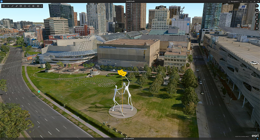
โดยซอฟต์แวร์ที่เหมาะที่จะใช้สร้างสรรค์ สร้างภาพ และวิเคราะห์ใน Digital Twins นั้นคือซอฟต์แวร์ ArcGIS ของ Esri ซึ่งเป็นโซลูชันพร้อมใช้และใช้งานง่ายจึงทำให้การทำงานมีประสิทธิภาพมากขึ้น นอกจากนั้นแผนที่และแอปต่าง ๆ ยังสามารถฝังอยู่ในเว็บไซต์เพื่อให้ทุกคนสามารถเข้าถึงข้อมูลที่จำเป็นได้เพื่อให้เกิดความเข้าใจและตัดสินใจทางธุรกิจได้อย่างแม่นยำ
ค้นหาศักยภาพของเทคโนโลยี GIS กับการประยุกต์ใช้ในอุตสาหกรรมอื่นๆ เพิ่มเติม