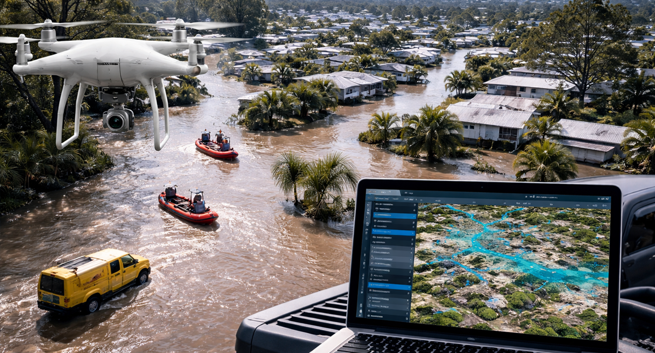
31 มี.ค. Drone Mapping ช่วยยกระดับการรับมืออุทกภัยในออสเตรเลียให้รวดเร็วและแม่นยำยิ่งขึ้น Posted at 15:55h in Blog ... Read More
26 ก.พ. Drone Mapping และ GIS ช่วยยกระดับการก่อสร้างรันเวย์สนามบินในสหรัฐอเมริกา Posted at 14:28h in Blog ... Read More
04 ก.พ. Drone Mapping และ Site Scan for ArcGIS เปลี่ยนข้อมูลโดรนและ Imagery ให้เป็นการตัดสินใจที่แม่นยำด้วย GIS Posted at 10:15h in Blog ... Read More