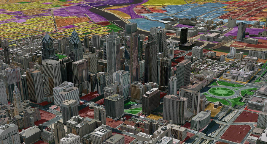
The Complicated Relationship between Business and Geography


Geography and business entwine in subtle and profound ways. Explore the surprising effects of geography—including the risks and opportunities it creates.

In the 1990s, at the dawn of the Internet era, it was common to hear speculation about “the death of distance” and “the end of geography.” Some predicted the rise of digital tools like email and e-commerce would make location nearly meaningless. Over three decades later, business and geography are as enmeshed as ever.

Consider the rise of artificial intelligence (AI): Today’s most talked-about technology operates on the level of neural networks and algorithms that seem untethered to the physical world. Yet the gigantic compute power for AI innovations comes from data centers that occupy fixed locations and could account for as much as a third of new electricity demand in the US over the next two years.

That leaves companies like Amazon, Microsoft, and Google attempting to balance the build-out of data centers against location-specific risks like flooding and heat waves, as well as corporate net-zero goals. It’s just one of today’s business challenges that’s all but impossible to solve without a map and the kind of context provided by geographic information system (GIS) technology.


Geography and Business—Intertwined in Strategy and Operations

A geographic approach allows executives to assess markets and analyze business operations in the context of global supply chains, environmental impacts, security risks, and other data. Operational basemaps have enabled timber companies to develop sustainable forestry programs that ensure healthy woodlands for decades to come, and have inspired omnichannel retail strategies that spark growth online and in stores. Geographic context also strengthens the hand of business leaders making tactical decisions. Smart maps can illuminate consumer trends that guide site selection for a new store, or shed light on risks posed by a factory’s water supply in a water-stressed region.

Business trends come and go, and industries rise and fall. But as long as people, nature, and businesses interact in specific locations, geography will matter.


Geopolitics, Fiscal and Monetary Policy, and Regulation

A company’s exposure to tariffs, taxes, and fiscal rules ties directly to location. An operational basemap allows companies to swiftly identify supply chains impacted by rules like the European Union’s carbon tax on imports. That awareness could help decision-makers target assets with poor energy efficiency or determine where carbon reduction systems would limit fees.

Such assessments involve a decision framework known as an OODA loop, which JPMorgan Chase CEO Jamie Dimon praised in his most recent letter to shareholders: observe, orient, decide, act.

Any decision-making involving the latest developments in global trade and fiscal policy begins with assessment—and assessment inevitably requires a grasp of location. Tactically, for instance, a bank might use GIS to analyze satellite imagery, assessing whether an agricultural company seeking investments conforms with biodiversity laws.

Amid the shifting geopolitics of international trade and a slew of climate-related regulations, GIS is providing critical context as executives observe policy adjustments and orient their enterprises to the changes.


Business Growth, Market Analysis, and Supply Chain Design

Businesses seeking expansion underestimate the importance of geography at their own risk. Some American retailers have famously stumbled when expanding, often because they overlooked the nuances of location. One prominent US retailer grew its store count to more than 5,000 in the middle of the last decade, making it a familiar landmark in most major cities. The CEO once counted eight stores operating within five miles of his house. But most locations couldn’t support such density, and stores began to cannibalize each other’s sales.

The right kind of assessment can unearth geographic trends conducive to success. At one of the Big Four advisory firms, location-savvy consultants use a GIS map enriched with population and zoning data to guide an e-commerce company to the most promising shopping district and even the best street for a new storefront.

Top retailers routinely use geographic and demographic analysis to choose store locations and design supply chains to support them.

Demand for analysts who understand the geography of logistics and shipping routes is so great that companies are partnering with universities to sponsor GIS-based competitions.


Climate Risks: Where to Bolster Resilience and Reduce Negative Impacts

In its annual Global Risks Report, the World Economic Forum revealed the top four long-term risks identified by experts in business, academia, and beyond. All four are environmental—including extreme weather events and biodiversity loss and ecosystem collapse—and all behave differently in different geographies.

Businesses are adopting a two-pronged response focused on reduction and resilience. At the heart of that approach is a geographic view of factors they can control—like their carbon footprints—and those they cannot, like projected sea level rise and predicted flooding impacts.

Some companies are building resilience with help from location technology by assessing which climate risks will affect certain geographies. Others are reducing their carbon profile by assessing operations in specific locations. One Swiss retailer used GIS to map the speed guidelines and road gradients of its truck routes to plan the most energy-efficient distribution strategy.


Optimizing Access to Natural Resources and Human Resources

A company’s geography determines its access to critical resources like lumber, mineral deposits, and water, and to the specialists needed to fill vacancies. Today, those insights are delivered at scale and in real time thanks to innovations in GIS.

For executives, smart maps can show the location of potential ore mines, harvestable timber, or potential preservation land. Just as importantly, they can indicate the roads heavy machinery might use to access a site, along with nearby conservation areas and available labor pools.

Water, a resource that many companies took for granted a decade ago, has become the number one sustainability concern for executives across industries. For a chipmaker whose semiconductor fab uses millions of gallons of water a day, reaching next decade’s growth target might require avoiding areas of water stress. Maps can highlight geographic regions less likely to be affected by drought.

GIS is also empowering workforce analysis. An HR executive can map market data on salaries across various regions and use that information to hone their hiring strategies in different locations.


Connecting with Communities and Customers

One way to describe the rise of the triple bottom line is that companies have broadened their pool of stakeholders. Whereas shareholders were once the sole focus, executives increasingly want to understand the relationships between products and services, customers and communities. That understanding is rooted in geography.

When one of the world’s largest tech firms sought to support nonprofits assisting Black Americans as part of an equity initiative, geography was a critical factor. With location technology, program leaders analyzed housing, education, and poverty data to identify areas of profound racial disparity. They then partnered with local nonprofits, provided them with funding and digital tools, and tracked equity indicators in the communities to measure the impacts of the program.

Companies are also increasingly lending support on the front lines of disaster response. Big retailers have used operational basemaps to distribute resources including masks and sandbags from warehouses to neighborhoods of need. They’ve also helped authorities stage water and food distribution sites in company parking lots.

The location data needed to perform these and other strategic tasks—in other words, to help companies orient and act—is growing in volume even as it decreases in cost, according to Deloitte & Touche managing director Jerry Johnston. As long as companies need to understand where something is—customers, competitors, resources, risks—geographic context will continue to grow in value.


Unleashing GIS Technology’s potential in every industries


Read more


ภูมิศาสตร์ตัวแปรสำคัญสร้างโอกาสเติบโตให้ธุรกิจ


“ธุรกิจและภูมิศาสตร์” ความสัมพันธ์ที่มากกว่าที่คิด

ในช่วงเริ่มต้นของอินเทอร์เน็ตในยุค 1990 มีการคาดการณ์เกี่ยวกับแนวคิด “The death of distance” และ “The end of geography” หลายคนทำนายว่าการเกิดขึ้นของเครื่องมือดิจิทัลอย่าง อีเมล และ อีคอมเมิร์ซ จะทำให้ “โลเคชัน” แทบไร้ความหมาย แต่ความจริงกลับตรงกันข้าม กว่าสามทศวรรษผ่านไปได้พิสูจน์ให้เห็นแล้ว “ธุรกิจและภูมิศาสตร์” ได้เชื่อมกันอย่างแนบแน่นอย่างไม่เคยเกิดขึ้นมาก่อน

ปัญญาประดิษฐ์ หรือ AI เป็นเทคโนโลยีที่ถูกพูดถึงมากที่สุดเพราะการทำงานเลียนแบบสมองมนุษย์และมีอัลกอริทึมที่ซับซ้อนเป็นอิสระเหนือกฎเกณฑ์ของโลกแห่งความจริง อย่างไรก็ตาม นวัตกรรม AI จำเป็นต้องใช้พลังงานไฟฟ้าจำนวนมหาศาลจาก Data center ที่มีสถานที่ตั้งตายตัว และมีการคาดการณ์ว่า AI จำเป็นต้องใช้พลังงานไฟฟ้ามากยิ่งขึ้นถึงหนึ่งในสามของความต้องการใช้ไฟฟ้าใหม่ทั้งหมดในสหรัฐอเมริกาในอีกสองปีข้างหน้า ปัญหาดังกล่าวทำให้บริษัท Amazon, Microsoft และ Google ต้องพยายามหาจุดสมดุลระหว่างการสร้าง Data center กับความเสี่ยงเฉพาะของพื้นที่ เช่น น้ำท่วมและคลื่นความร้อน รวมถึงต้องคำนึงถึงเป้าหมาย Net zero ขององค์กรอีกด้วย นี่เป็นเพียงหนึ่งในความท้าทายทางธุรกิจในปัจจุบันที่อาจแก้ไขไม่ได้ถ้าปราศจาก แผนที่ และ ข้อมูลเชิงพื้นที่ที่ได้จากเทคโนโลยีระบบสารสนเทศภูมิศาสตร์ (GIS)


“ภูมิศาสตร์และธุรกิจ” เพื่อกลยุทธ์และการดำเนินงาน

“แนวคิดทางภูมิศาสตร์” ช่วยให้นักบริหารประเมินตลาดและวิเคราะห์การดำเนินงานโดยพิจารณาจากปัจจัยต่าง ๆ ตั้งแต่ห่วงโซ่อุปทานทั่วโลก ผลกระทบต่อสิ่งแวดล้อม ความเสี่ยงด้านความปลอดภัย และข้อมูลอื่นๆ เช่น “Operational basemap” ช่วยให้บริษัทค้าไม้พัฒนาโครงการการป่าไม้ที่ยั่งยืนเพื่อรักษาป่าไม้ให้แข็งแรงในระยะยาว และทำให้เกิดกลยุทธ์การค้าปลีกแบบ Omnichannel ที่สร้างการเติบโตทั้งออนไลน์และในร้านค้า ส่วน “บริบททางภูมิศาสตร์” ก็สามารถช่วยให้ผู้นำธุรกิจตัดสินใจได้ดียิ่งขึ้น ทั้ง “Smart map” ก็ชี้ให้เห็นแนวโน้มของผู้บริโภคซึ่งส่งผลต่อการเลือกสถานที่ตั้งร้านค้าใหม่ หรือชี้ให้เห็นความเสี่ยงของโรงงานในภูมิภาคที่ขาดแคลนน้ำได้

แม้แนวโน้มธุรกิจอาจเปลี่ยนไป อุตสาหกรรมอาจผันผวน แต่ตราบใดที่มนุษย์ ธรรมชาติ และธุรกิจ ยังคงผูกพันกันบนพื้นที่ใดพื้นที่หนึ่งบนโลก “ภูมิศาสตร์” จะยังคงเป็นตัวแปรสำคัญที่ส่งผลต่อทุกการตัดสินใจ


ภูมิรัฐศาสตร์ นโยบายการคลังและการเงิน และกฎเกณฑ์ต่าง ๆ

ทราบหรือไม่ว่าสถานที่ตั้งของบริษัทนับว่ามีความเสี่ยงในด้านภาษีสรรพสามิต ภาษีอื่น ๆ และกฎเกณฑ์ทางการเงินต่าง ๆ เช่น ในเรื่องภาษีคาร์บอนนำเข้าของสหภาพยุโรป บริษัทสามารถนำ Operational basemap มาใช้เพื่อระบุห่วงโซ่อุปทานที่ได้รับผลกระทบ ซึ่งช่วยให้ผู้มีอำนาจตัดสินใจระบุสินทรัพย์ที่ใช้พลังงานไม่มีประสิทธิภาพ หรือระบุสถานที่ที่ควรติดตั้งระบบลดคาร์บอนเพื่อจำกัดค่าใช้จ่ายต่อไป

การประเมินความเสี่ยงดังกล่าวเกี่ยวข้องกับกรอบการตัดสินใจที่เรียกว่า “OODA Loop” อันประกอบด้วย การสังเกต (Observe) ปรับทิศทาง (Orient) ตัดสินใจ (Decide) และลงมือทำ (Act) ซึ่ง Jamie Dimon ผู้ดำรงตำแหน่ง CEO ของบริษัท JPMorgan Chase ได้กล่าวถึงในจดหมายถึงผู้ถือหุ้นเมื่อไม่นานมานี้ ไม่ว่าจะทำการตัดสินใจเกี่ยวกับการค้าโลกและนโยบายการคลังใด ๆ ขั้นตอนแรกที่สำคัญคือการประเมินความเสี่ยง ซึ่งการประเมินนั้นต้องเข้าใจสถานที่ตั้งด้วย เช่น หากธนาคารต้องการให้เงินทุนแก่บริษัทเกษตรกรรมแห่งหนึ่ง สามารถเทคโนโลยี GIS ทำการวิเคราะห์ภาพถ่ายดาวเทียม เพื่อประเมินว่าบริษัทนั้นทำเกษตรกรรมสอดคล้องกับกฎหมายความหลากหลายทางชีวภาพหรือไม่

ในโลกปัจจุบันที่ภูมิรัฐศาสตร์มีการเปลี่ยนแปลง ทั้งในเรื่องการค้าขายระหว่างประเทศ และกฎหมายเกี่ยวกับสภาพภูมิอากาศ เทคโนโลยี GIS ถือเป็นเครื่องมือที่จำเป็นอย่างยิ่งสำหรับผู้บริหารยุคใหม่ เพื่อใช้ติดตามการปรับเปลี่ยนนโยบายต่าง ๆ พร้อมปรับธุรกิจให้เท่าทันสถานการณ์ที่เปลี่ยนไป


การเติบโตทางธุรกิจ การวิเคราะห์ตลาด และการออกแบบห่วงโซ่อุปทาน

ธุรกิจที่มุ่งขยายกิจการมักพบความเสี่ยงจากการประเมินความสำคัญของภูมิศาสตร์ต่ำเกินไป มีตัวอย่างมากมายของร้านค้าปลีกในสหรัฐอเมริกาที่ไม่สบความสำเร็จในการขยายธุรกิจ เพราะมองข้ามรายละเอียดปลีกย่อยของทำเลที่ตั้ง

หนึ่งในนั้นคือ ร้านค้าปลีกชื่อดังของสหรัฐฯ ที่ขยายสาขามากกว่า 5,000 สาขาในช่วงกลางทศวรรษที่ผ่านมา จนกลายเป็นสถานที่คุ้นตาของคนในหลาย ๆ เมืองใหญ่ เยอะขนาดที่ CEO ของบริษัทฯ เคยนับร้านค้าได้ถึง 8 สาขาแค่ในระยะ 5 ไมล์จากบ้านของเขา แต่นั่นไม่ใช่ข้อดีนัก เพราะทำเลส่วนใหญ่มีร้านค้าตั้งใกล้กันเกินไป ทำให้เกิดการแย่งลูกค้ากันเอง

การประเมินความเสี่ยงอย่างถูกวิธีจะทำให้เห็นแนวโน้มทางภูมิศาสตร์และนำไปสู่ความสำเร็จของธุรกิจในที่สุด ตัวอย่างหนึ่งคือ ที่ปรึกษาผู้เชี่ยวชาญด้านโลเคชันของบริษัทที่ปรึกษาชั้นนำระดับโลกแห่งหนึ่งเลือกใช้แผนที่ GIS เพื่อวิเคราะห์ข้อมูลประชากรและการแบ่งเขต ทำให้สามารถแนะนำบริษัทอีคอมเมิร์ซได้ว่าควรเปิดร้านค้าใหม่ในย่านการค้าใดที่น่าสนใจที่สุด และถนนใดที่ดีที่สุด

เทคโนโลยี GIS ถูกนำมาใช้มากขึ้นเพื่อช่วยร้านค้าชั้นนำทำการวิเคราะห์ทางภูมิศาสตร์และประชากรศาสตร์ เพื่อเลือกทำเลที่ตั้งสาขา และออกแบบห่วงโซ่อุปทานให้มีประสิทธิภาพยิ่งขึ้น

ยิ่งไปกว่านั้น ความต้องการนักวิเคราะห์ที่เข้าใจภูมิศาสตร์ของโลจิสติกส์และเส้นทางการขนส่งก็เพิ่มสูงขึ้นอย่างมากด้วยเช่นกัน จนบริษัทต่างๆ ได้ทำความร่วมมือกับมหาวิทยาลัยเพื่อแข่งขันคัดคนที่ใช้เครื่องมือ GIS เก่ง ๆ เข้าร่วมงาน


โลกเปลี่ยนไป เราจะรับมือและลดผลกระทบได้อย่างไร

รายงาน Global Risks Report ประจำปีของ The World Economic Forum เผยถึงความเสี่ยงระยะยาว 4 อันดับแรกที่ระบุโดยผู้เชี่ยวชาญภาคธุรกิจ ภาคการศึกษา และภาคอื่นๆ ซึ่งล้วนเกี่ยวกับสิ่งแวดล้อมทั้งสิ้น ไม่ว่าจะเป็นสภาพอากาศสุดขั้ว การสูญเสียความหลากหลายทางชีวภาพ และการพังทลายของระบบนิเวศ ทั้งความเสี่ยงเหล่านี้ได้ส่งผลกระทบแตกต่างกันไปในแต่ละพื้นที่

ในการแก้ปัญหาดังกล่าวจำเป็นต้องทำ 2 อย่างควบคู่กัน คือ การลดผลกระทบ และการเตรียมพร้อมรับมือ ซึ่งหัวใจสำคัญของการแก้ปัญหานี้คือ การพิจารณาปัจจัยต่าง ๆ ผ่านมุมมองทางภูมิศาสตร์ ทั้งปัจจัยที่ควบคุมได้ เช่น การลดการปล่อยก๊าซคาร์บอน และปัจจัยที่ควบคุมไม่ได้ เช่น การเพิ่มขึ้นของระดับน้ำทะเล และผลกระทบจากน้ำท่วมที่คาดการณ์ไว้

บางบริษัทใช้เทคโนโลยีด้านโลเคชันเพื่อสร้างความพร้อมในการรับมือ โดยประเมินความเสี่ยงของสภาพอากาศที่อาจกระทบในบางพื้นที่ ในขณะที่อีกหลายบริษัททำการลดการปล่อยก๊าซคาร์บอนของตน โดยประเมินการทำงานของพื้นที่นั้น ๆ เช่น ร้านค้าปลีกสัญชาติสวิสแห่งหนึ่งใช้เทคโนโลยี GIS สร้างแผนที่แสดงความเร็วและความชันของถนน เพื่อวางกลยุทธ์การกระจายสินค้าที่ใช้พลังงานมีประสิทธิภาพที่สุด เป็นต้น


เข้าถึงทรัพยากรธรรมชาติและทรัพยากรมนุษย์

ที่ตั้งของธุรกิจในพื้นที่ต่างกันย่อมส่งผลต่อการเข้าถึงทรัพยากรที่ต่างกัน ไม่ว่าจะเป็นทรัพยากรธรรมชาติ เช่น ไม้ แร่ และน้ำ และทรัพยากรมนุษย์ที่เชี่ยวชาญงานที่บริษัทต้องการ แต่ด้วยเทคโนโลยี GIS ทำให้บริษัทมีข้อมูลเชิงลึกในแบบเรียลไทม์มากเพียงพอที่จะช่วยในการตัดสินใจได้อย่างมีประสิทธิภาพ

เทคโนโลยี GIS ช่วยให้ผู้บริหารสามารถใช้ Smart map เพื่อค้นหาตำแหน่งของแหล่งแร่ที่อาจจะขุดได้ ป่าไม้ที่สามารถตัดได้ หรือพื้นที่ที่มีศักยภาพเป็นพื้นที่อนุรักษ์ นอกจากนั้น ยังสามารถระบุถนนที่เครื่องจักรหนักสามารถเข้าไปในพื้นที่ รวมถึงพื้นที่อนุรักษ์ใกล้เคียง ไปจนกระทั่งแหล่งแรงงานที่พร้อมทำงานได้

อีกหนึ่งปัญหาสำคัญในปัจจุบันคือการขาดแคลนน้ำ เมื่อก่อนหลายบริษัทคิดว่าน้ำเป็นทรัพยากรที่หาได้ง่าย แต่เดี๋ยวนี้น้ำกลายเป็นปัญหาสำคัญในการดำเนินธุรกิจอย่างยั่งยืน โดยเฉพาะบริษัทที่มีโรงงานที่ต้องใช้น้ำจำนวนมหาศาลทุกวันอย่างบริษัทผลิตชิป เพื่อการเติบโตในระยะยาวการเลือกตั้งโรงงานจึงควรหลีกเลี่ยงพื้นที่ที่ขาดแคลนน้ำ และการใช้ Smart map ย่อมช่วยให้บริษัทมองเห็นพื้นที่ทางภูมิศาสตร์ที่มีความเสี่ยงจากภัยแล้งน้อยที่สุดได้

นอกจากนั้น เทคโนโลยี GIS ยังช่วยในการวิเคราะห์ข้อมูลเกี่ยวกับกำลังคน เช่น ผู้บริหารฝ่าย HR สามารถสร้างแผนที่แสดงข้อมูลเงินเดือนในแต่ละพื้นที่ เพื่อวางแผนการจ้างงานให้เหมาะสมกับพื้นที่นั้น ๆ เป็นต้น


เชื่อมความสัมพันธ์ของชุมชนและลูกค้า

การทำธุรกิจโดยคำนึงถึงสามด้าน นั่นคือ กำไร สังคม และสิ่งแวดล้อม ได้รับความนิยมมากขึ้นเรื่อย ๆ ในอดีตธุรกิจต่างมุ่งเน้นสร้างกำไรให้ผู้ถือหุ้นเป็นหลัก แต่ปัจจุบันผู้บริหารเริ่มตระหนักถึงความสำคัญของความสัมพันธ์ระหว่างผลิตภัณฑ์และบริการ ลูกค้า และชุมชนมากขึ้น ซึ่งความเข้าใจเหล่านี้ล้วนเกี่ยวข้องกับภูมิศาสตร์ทั้งสิ้น

ภูมิศาสตร์ถือเป็นปัจจัยสำคัญเมื่อบริษัทเทคโนโลยียักษ์ใหญ่ระดับโลกแห่งหนึ่งต้องการสนับสนุนองค์กรไม่แสวงผลกำไรที่ช่วยเหลือชาวอเมริกันผิวดำเพื่อส่งเสริมความเท่าเทียม หัวหน้าโครงการจึงใช้เทคโนโลยีด้านโลเคชันวิเคราะห์ข้อมูลด้านที่อยู่อาศัย การศึกษา และความยากจน เพื่อระบุพื้นที่ที่มีความเหลื่อมล้ำทางเชื้อชาติอย่างชัดเจน จากนั้นจึงร่วมมือกับองค์กรไม่แสวงผลกำไรในพื้นที่ทำการมอบเงินทุนและเครื่องมือดิจิทัลต่าง ๆ และทำการติดตามตัวชี้วัดความเท่าเทียมในชุมชนเพื่อประเมินผลโครงการต่อไป

ปัจจุบัน เราได้เห็นความใส่ใจของบริษัทต่าง ๆ ในการช่วยเหลือผู้ประสบภัยพิบัติมากขึ้น เช่น ร้านค้าปลีกขนาดใหญ่ได้ใช้ Operational basemap ในการกระจายเครื่องมือและอุปกรณ์ช่วยเหลือต่าง ๆ ทั้งหน้ากากอนามัยและกระสอบทรายจากโกดังสินค้าไปยังชุมชนที่ต้องการ และช่วยหน่วยงานภาครัฐจัดตั้งจุดแจกจ่ายน้ำและอาหารในลานจอดรถของบริษัท เป็นต้น

Jerry Johnston กรรมการผู้จัดการของบริษัท Deloitte & Touche กล่าวว่า ข้อมูลเกี่ยวกับโลเคชันที่ใช้ในการวางแผนและดำเนินงานต่าง ๆ ของบริษัทมีปริมาณมากขึ้นเรื่อย ๆ ในขณะที่ต้นทุนกลับลดลง นั่นหมายความว่า ตราบใดที่บริษัทยังต้องการรู้ว่าสิ่งต่าง ๆ อยู่ที่ไหน ไม่ว่าจะเป็นลูกค้า คู่แข่ง ทรัพยากร ไปจนกระทั่งความเสี่ยง บริบททางภูมิศาสตร์จะมีความสำคัญและมีมูลค่าเพิ่มมากขึ้นเรื่อย ๆ ด้วยเช่นกัน


ค้นหาศักยภาพของเทคโนโลยี GIS กับการประยุกต์ใช้ในอุตสาหกรรมอื่นๆ เพิ่มเติม


อ่านเพิ่มเติม