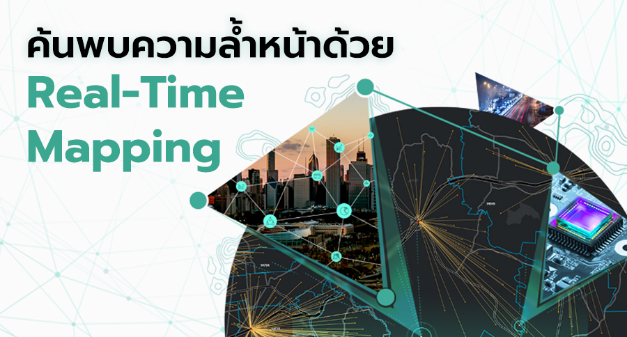
Exploring a Breakthrough in Real-Time Mapping

Author: Chris Nickola

An emerging form of real-time mapping is giving companies a new way to make workplaces safer and more efficient. Powered by a geographic information system (GIS), the new capability is a sophisticated twist on a technique called geofencing. A typical geofence recognizes when a car, mobile phone, or other object moves into a digitally “fenced” area and triggers a corresponding alert or action. For instance, a home goods store could set up a geofence around the surrounding square block area. When a customer using the company’s mobile app crosses that threshold, location technology would trigger a notification about a sale or a popular item that’s back in stock.

Now, real-time mapping—showcased in the video below—enables organizations to track the proximity of multiple moving objects and issue alerts when they near one another.

In business settings where vehicle operators work in close proximity and with limited visibility—such as warehouses, solar energy installations, or airports—these automated geofencing alerts can reduce accidents and ensure smoother workflows. In addition, by analyzing the data streams of moving assets, managers gain location intelligence on the patterns that shape everyday business operations.

Real-Time Mapping in Whiteout Conditions

The video of this technology at work shows a ski area where the operator has employed dynamic geofencing to alert drivers of snowmobiles and snowplows to each other’s presence. The principles at play could just as easily apply to companies managing shipyards, rail terminals, vineyards, or rental car lots.

Inclement weather, rugged terrain, obstacles, and nighttime conditions can make it difficult for operators of vehicles and moving machinery to see each other. The ski company was facing thick precipitation and mountainous topography that created dangerous gaps in visibility for employees crisscrossing the slopes.

Real-time mapping enables a manager to set borders around moving assets such as trucks, construction vehicles, cranes, utility trucks, baggage buggies, and even planes. If those borders come within a set distance of one another, operators automatically receive an alert to slow down and look out for another vehicle.

Using sophisticated location science, GIS avoids false alarms by accounting for places where moving objects can’t meet. For instance, if a snowmobile and snowplow pass within 250 feet of each other, yet are separated by a dense stand of trees, no alert is issued.

Taking Guesswork Out of Safer Workplaces

Real-time mapping can also apply to large areas. For instance, a logistics company could use dynamic geofencing to monitor fast-moving storms and planes, generating alerts whenever pilots approach dangerous weather patterns. Alternately, a delivery company could track the movement of trucks in relation to protests, parades, or motorcades to help drivers avoid crowded areas or traffic.

In the longer term, data analysis of spatial patterns could inform executive decisions. Historical analysis might reveal operational areas with a higher likelihood of collisions. In response, facility managers could increase safety signage or better manage traffic and vehicles in specific areas.

By incorporating the latest advances in real-time mapping, business leaders can take the guesswork out of creating safer workplaces, and give workers greater peace of mind.


Unleashing GIS Technology’s potential in every industries


Read more


ค้นพบความล้ำหน้าด้วย Real-Time Mapping

ความล้ำหน้าของ Real-time mapping ช่วยเพิ่มความปลอดภัยและประสิทธิภาพให้กับที่ทำงาน และด้วยเทคโนโลยี GIS ยิ่งช่วยเพิ่มความสามารถให้กับการกำหนดขอบเขตเสมือน หรือ Geofencing ได้ดียิ่งขึ้น ซึ่งเทคนิค Geofencing โดยทั่วไปจะทำการกำหนดขอบเขตพื้นที่ของรถ มือถือ และวัตถุที่เคลื่อนไหวต่าง ๆ ในรูปแบบดิจิตอล และทำการแจ้งเตือนเมื่อวัตถุเข้าใกล้ขอบเขตนั้น ๆ เช่น ร้านค้าประเภทของใช้ในบ้านสามารถกำหนด Geofence บริเวณรอบร้านค้า และเมื่อลูกค้าใช้โมบายแอปของบริษัทภายในบริเวณที่กำหนด ก็จะทำการแจ้งเข้ามือถือลูกค้าเพื่อแจ้งโปรโมชันหรืออาจแจ้งข่าวสินค้ายอดนิยมกลับมาวางจำหน่ายอีกครั้ง เป็นต้น

ปัจจุบัน Real-time mapping ที่แสดงอยู่ในวิดีโอข้างล่างนี้ ทำให้บริษัทสามารถติดตามระยะของวัตถุที่เคลื่อนไหวหลาย ๆ อย่างพร้อมกัน และแจ้งเตือนเมื่อสิ่งเหล่านั้นเข้าใกล้กันได้

การแจ้งเตือนแบบอัตโนมัติของ Geofencing สามารถลดอุบัติเหตุในที่ทำงาน และทำให้การทำงานลื่นไหลยิ่งขึ้น โดยเฉพาะสถานที่ทำงานที่มียานพาหนะอยู่ใกล้กันและมีระยะการมองเห็นที่จำกัด เช่น ภายในคลังสินค้า การติดตั้งพลังงานงานแสงอาทิตย์ หรือแม้กระทั่งสนามบิน ยิ่งไปกว่านั้น การวิเคราะห์ Data stream ยังช่วยให้หัวหน้างานได้ข้อมูลจาก Location intelligence และทราบถึงแพทเทิร์นต่าง ๆ ที่นำมาปรับใช้ในการทำงานประจำวันได้

Real-Time Mapping ในสถานการณ์หิมะขาวโพลน

วิดีโอนี้แสดงถึงเทคโนโลยีในที่ทำงานของสถานที่เล่นสกีแห่งหนึ่ง ซึ่งผู้ควบคุมยานพาหนะสามารถใช้ Geofencing เพื่อแจ้งเตือนให้ผู้ขับขี่ทั้งรถ Snowmobile และรถ Snowplow ทราบถึงตำแหน่งของกันและกัน และหลักการเดียวกันนี้สามารถนำไปปรับใช้กับธุรกิจอื่น ๆ ได้ เช่น อู่ต่อเรือ สถานีรถไฟ ไร่องุ่น หรือลานจอดรถเช่า

ผู้ควบคุมยานพาหนะหรือเครื่องจักรที่มีการเคลื่อนไหวอาจเผชิญอุปสรรคในการมองเห็นกันและกันเนื่องจากสภาพอาการแปรปรวน ถนนขรุขระ มีสิ่งกีดขวางต่าง ๆ รวมทั้งสภาวะกลางคืน เช่น บริษัทสกีที่มักต้องเผชิญกับหิมะที่ตกหนก และภูมิประเทศแบบภูเขาซึ่งอาจเป็นอันตรายต่อพนักงานที่อาจมองไม่เห็นระหว่างขับขึ้นลงทางชัน

ทั้งนี้ Real-time mapping ช่วยให้หัวหน้างานสร้างขอบเขตรอบ ๆ สินทรัพย์ที่เคลื่อนที่ เช่น รถบรรทุก รถก่อสร้าง เครน รถกระบะ รถบักกี้ หรือแม้กระทั่งเครื่องบิน หากขอบเขตของรถคันใดเข้าใกล้ระยะห่างที่ตั้งไว้ของรถอีกคัน ผู้ควบคุมจะได้รับการเตือนอัตโนมัติเพื่อทำการชะลอและเพิ่มความระมัดระวังความปลอดภัย นอกจากนั้น การใช้วิทยาศาสตร์ด้านโลเคชันที่ซับซ้อนยิ่งขึ้นแบบเทคโนโลยี GIS ก็ช่วยเลี่ยงการเกิด False alarm ด้วยการดูความเป็นไปได้ของสถานที่ที่วัตถุเคลื่อนผ่านกันนั้นอาจไม่สามารถเจอกันได้ เช่น แม้ว่า Snowmobile และ Snowplow จะขับผ่านกันภายใน 250 ฟุต แต่ทั้งสองถูกขั้นด้วยต้นไม้จำนวนมาก เช่นนี้ก็จะไม่เกิดการแจ้งเตือนขึ้น

เพิ่มความปลอดภัยเพราะไม่จำเป็นต้องคาดเดาอีกต่อไป

Real-time mapping สามารถนำไปใช้ในพื้นที่ขนาดใหญ่ได้ เช่น บริษัทโลจิสติกส์สามารถใช้ Geofencing เพื่อมอนิเตอร์เครื่องบินและพายุที่เคลื่อนที่มาอย่างรวดเร็ว และทำการแจ้งเตือนเมื่อนักบินกำลังเผชิญสภาพอากาศที่เป็นอันตราย หรือในอีกกรณีหนึ่ง บริษัทด้านการขนส่งสามารถติดตามการเคลื่อนที่ของรถบรรทุกหากภายในเมืองมีการประท้วง มีพาเหรด หรือขบวนคาราวาน เพื่อช่วยให้คนขับหลีกเลี่ยงพื้นที่แออัดหรือรถติดได้ นอกจากนั้น ในระยะยาวการวิเคราะห์ข้อมูลด้านพื้นที่ในรูปแบบต่าง ๆ ย่อมช่วยให้ผู้บริหารตัดสินใจได้ดียิ่งขึ้น รวมทั้งประวัติการวิเคราะห์ยังช่วยให้ Facility manager เห็นพื้นที่ที่มีความเสี่ยงที่อาจเกิดการชนกัน จึงอาจเพิ่มป้ายความปลอดภัย หรือจัดการการจราจรและยานพาหนะให้ดียิ่งขึ้นในพื้นที่ที่มีปัญหาเหล่านั้น

การนำเทคโนโลยีล่าสุดอย่าง Real-time mapping มาใช้ย่อมช่วยให้ผู้นำทางธุรกิจไม่ต้องคาดเดาอีกต่อไป และยิ่งเพิ่มความปลอดภัยให้คนทำงานและพื้นที่ทำงานยิ่งขึ้น


ค้นหาศักยภาพของเทคโนโลยี GIS กับการประยุกต์ใช้ในอุตสาหกรรมอื่นๆ เพิ่มเติม


อ่านเพิ่มเติม