Evs and new ways of living fueled by location intelligence

The transition to electric vehicles (EV) represents a long overdue response to the ongoing climate emergency. California, having by far more registered cars than any state in the nation, has pledged to cease sales of new fossil fuel-burning cars by 2035, and automotive companies are increasing EV production.

The Infrastructure Investment and Jobs Act will invest $5 billion to expand EV charging networks across the country. And the Inflation Reduction Act (IRA) lifts the per-manufacturer limit on the number of cars that can receive a plug-in electric vehicle tax credit. A rebate is offered even on used EVs to extend the benefit to all. Given that transportation is the greatest contributor to greenhouse gases, the combined investment and incentives put the United States within reach of its Paris Agreement commitment to cut emissions by half by 2030.

However, these changes also present new challenges. Mining lithium in sufficient quantities to withstand demand for EV batteries is itself carbon intensive and raises concerns over environmental degradation, resource extraction, and human rights. Additionally, EV charging infrastructure remains underdeveloped. Potential EV owners are reluctant to make purchases until charging station networks improve, while private investors that would finance EV infrastructure are waiting for EV production to catch up to demand.

These challenges require insights not only about where best to place new EV chargers but also in regard to broader urban plans and infrastructure practices. EV crossover represents a completely reimagined way for us to move and live. And the push to reduce dependence on fossil fuels is driving a transformation of our transportation infrastructure.

Location intelligence provides the means to examine these complex issues and achieve clarity on viable solutions.


Illinois’s EVTown Paves the Way for Sustainable Practices

The city of Normal, Illinois, has long seen itself as an important outpost of the EV revolution. In 2011, after enticing Mitsubishi to open a plant to manufacture the i-MiEV—an innovative electric car that proved too early to market—Normal dubbed itself “EVTown.”Mitsubishi’s arrival coincided with the city’s Sustainable Normal plan, which included new bike trails and walkways, nature-based stormwater solutions, a revamped train station, and investments in renewable energy and EV charging stations.

Six years later, Rivian, an EV company backed by Amazon, bought the former Mitsubishi factory and expanded it to four million square feet with production lines for trucks, SUVs, and Amazon delivery vehicles. The city’s commitment to sustainability and transparency was a major factor in the company’s decision to build operations in Normal.

To achieve their mission, city planners in Normal rely on location intelligence for making decisions and tracking progress. GIS maps and dashboards enable project visualization and analysis across teams and departments while also facilitating public communication and data sharing

Residents can also access GIS maps and dashboards online to see the city’s project plans and verify that investments are equitable across the city. “The purpose of this tool is to make it easier for the public to know exactly what’s going on in their neighborhood,” said Vasudha Gadhiraju, director of Normal’s Innovation and Technology Department.

For transparency, the city recently extended its use of GIS to Normal’s Community Investment Plan. Previously, the plan was posted online in a spreadsheet, a format that was not easy to understand and was time-consuming to update. Now, anyone can easily view the information and examine projects in relation to their geographic location.

Cassidy Killian, Normal’s GIS coordinator, oversaw the creation of department-level dashboards. Using GIS, staff across departments can filter their data, record ongoing projects, and find metrics by project type. “The biggest benefit is seeing who is doing what and where, getting that overall picture in one place,” Killian said.

Because each department shares its data, staff can identify project conflicts and track funding sources to coordinate project phases. For example, if a water main project has approval, the water department can view the scope and timetable for road improvements at the same location as the project, eliminating the frustration of having to cut into freshly paved roads.

Urban planners are applying their GIS-based planning and analysis to the renewal of the city center, called Uptown Normal. The work started by replacing a dangerous five-way intersection with a pedestrian-friendly roundabout and community plaza known as Uptown Circle. The traffic-calming effect has made Uptown Normal a more attractive setting for businesses and housing, increasing property values while triggering new investment.

The city also created a GIS-powered business directory that shares Uptown Normal’s dining, shopping, entertainment, and lodging options—useful to visitors, residents, and the 21,000 students at Illinois State University. The directory automates the business licensing process, drawing data directly from each company’s required submissions. If a business is not on the map, its license isn’t current.

As part of its sustainability commitment, Normal uses location intelligence to identify projects that promote active and multimodal transportation. Projectsinclude the extension of a trail network to new suburbs and the expansion of the bike trail along historic Route 66 that links the town to five other communities. And the new Uptown Connector Underpass will provide pedestrian and bicycle passage beneath the railroad tracks, increasing access to railway platforms and enhancing safety for high-speed trains.


Location intelligence เพื่อยานยนต์ไฟฟ้าและวิถีชีวิตแห่งอนาคต

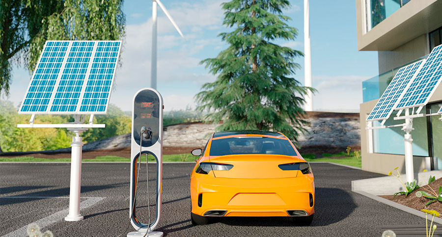
การเปลี่ยนยุคสู่ยานยนต์ไฟฟ้า (EV) เป็นการแก้ปัญหาวิกฤติทางสภาพอากาศที่น่าจะเกิดขึ้นเร็วกว่านี้ แม้แต่ในรัฐแคลิฟอร์เนียซึ่งมีการจดทะเบียนรถมากที่สุดในประเทศสหรัฐอเมริกา ปัจจุบันก็ได้ประกาศหยุดการขายรถยนต์ที่ใช้น้ำมันเชื้อเพลิงภายในปี ค.ศ. 2035 และบริษัทผู้ผลิตยานยนต์ต่างก็เร่งเพิ่มการผลิตรถยนต์ไฟฟ้าให้มากยิ่งขึ้น

เนื่องจากการขนส่งสร้างผลกระทบต่อการปล่อยก๊าซเรือนกระจกอย่างมาก สหรัฐจึงมีนโยบายด้านการลงทุนและการจูงใจด้วยส่วนลดหย่อน เพื่อลดการปล่อยก๊าซเรือนกระจกลงครึ่งหนึ่งภายในปี ค.ศ. 2030 ตามความตกลงปารีส (Paris Agreement) ผ่านกฎหมายต่าง ๆ เช่น กฎหมาย Infrastructure Investment and Jobs Act ที่ตั้งเป้าลงทุน 5 พันล้านบาทเพื่อขยายเครือข่ายสถานีชาร์จรถยนต์ไฟฟ้าทั่วประเทศ และกฎหมายลดอัตราเงินเฟ้อ หรือ IRA ที่ยกเลิกปริมาณการขายรถยนต์ไฟฟ้าที่ได้เครดิตภาษี ทั้งยังมีส่วนลดให้กับผู้ซื้อรถยนต์ไฟฟ้ามือสอง เป็นต้น

อย่างไรก็ดี การเปลี่ยนแปลงนี้ก็นำไปสู่ความท้าทายใหม่ เช่น ปัญหาการปล่อยก๊าซคาร์บอนในปริมาณมากจากการทำเหมืองลิเทียมเพื่อผลิตแบตเตอรี่รถยนต์ไฟฟ้าให้มากพอต่อความต้องการ ปัญหาการทำลายสิ่งแวดล้อม ปัญหาด้านการสกัดแร่ และปัญหาสิทธิมนุษยชน นอกจากนั้น โครงสร้างพื้นฐานสำหรับการชาร์จรถยนต์ไฟฟ้าในปัจจุบันก็ยังไม่มากพอ ทำให้ผู้ที่สนใจต้องชะลอการตัดสินใจซื้อจนกว่าเครือข่ายสถานีชาร์จรถยนต์ไฟฟ้าจะมีเพียงพอ ในขณะเดียวกันนักลงทุนเอกชนที่พร้อมลงทุนด้านโครงสร้างพื้นฐานของรถยนต์ไฟฟ้าก็ยังรอดูท่าทีจนกว่าปริมาณการผลิตรถยนต์ไฟฟ้าจะมากพอกับความต้องการของผู้บริโภค

ความท้าทายเหล่านี้จำเป็นต้องการข้อมูลเชิงลึกที่ไม่เพียงวิเคราะห์จุดที่ดีที่สุดสำหรับตั้งสถานีชาร์จรถยนต์ไฟฟ้า แต่ยังต้องคำนึงถึงการวางผังเมืองและโครงสร้างพื้นฐานของเมืองด้วย เพราะการเปลี่ยนยุคสู่รถยนต์ไฟฟ้าแทนการใช้เชื้อเพลิงทำให้มนุษย์เปลี่ยนวิถีการใช้ชีวิตและการเดินทาง ทั้งการลดการพึ่งพาพลังงานเชื้อเพลิงยังส่งผลให้โครงสร้างพื้นฐานของระบบขนส่งเกิดการเปลี่ยนแปลงครั้งสำคัญอีกด้วย

Location intelligence เป็นเครื่องมือสำคัญที่ทำให้เราสามารถศึกษาประเด็นที่ซับซ้อนเหล่านี้ และค้นพบโซลูชันที่เป็นไปได้


EVTown ในรัฐอิลลินอย ต้นแบบเมืองแห่งความยั่งยืน

เมืองนอร์มอล ในรัฐอิลลินอย ถือเป็นฐานสำคัญของการปฏิวัติยานยนต์ไฟฟ้า โดยเมื่อปี ค.ศ. 2011 มีการเชิญบริษัทมิตซูบิชิมาเปิดโรงงานการผลิตนวัตกรรมยานยนต์ i-MiEV ซึ่งขณะนั้นนับว่ามาเร็วกว่าความต้องการในตลาดไปมาก และภายหลังเมืองนี้จึงถูกเรียกว่า “EVTown” การเปิดโรงงานของมิตซูบิชิในเวลานั้นเกิดขึ้นพร้อมกับการวางแผนความยั่งยืนของเมือง ซึ่งมีการสร้างเส้นทางใหม่ให้จักรยานและทางเดินเท้า การจัดการปัญหาน้ำฝน การปรับปรุงสถานีรถไฟ และการลงทุนในพลังงานทดแทนและสถานีชาร์จรถยนต์ไฟฟ้า และหกปีหลังจากนั้น บริษัทรถยนต์ไฟฟ้า Rivian ซึ่งได้รับการสนับสนุนจากบริษัท Amazon ได้เข้าซื้อโรงงานเก่าของมิตซูบิชิและขยายพื้นที่เพิ่มเป็นสี่ล้านตารางฟุตเพื่อผลิตรถบรรทุก รถยนต์ SUV และรถส่งสินค้าของ Amazon โดยเหตุผลหลักที่บริษัทตัดสินใจมาทำกิจการที่เมืองนอร์มอลนี้ก็เพราะนโยบายของเมืองที่มุ่งมั่นด้านความยั่งยืนและความโปร่งใส

การที่เมืองนอร์มอลจะบรรลุตามเป้าหมายที่ตั้งไว้ได้นั้น นักวางผังเมืองจึงเลือกใช้ Location intelligence เพื่อช่วยในการตัดสินใจและติดตามความคืบหน้าของโครงการ ซึ่งแผนที่ GIS และ Dashboard ช่วยให้เจ้าหน้าที่เห็นภาพทั้งหมดของโครงการและสามารถวิเคราะห์ข้อมูลร่วมกับทีมงานและหน่วยงานต่าง ๆ ทั้งยังสามารถสื่อสารและแบ่งปันข้อมูลให้กับประชาชนได้อย่างสะดวก

นอกจากนั้น ประชาชนก็สามารถใช้แผนที่ GIS และ Dashboard แบบออนไลน์เพื่อดูแผนของโครงการและตรวจสอบการลงทุนภายในเมืองให้มีความเท่าเทียมกันได้ โดย Vasudha Gadhiraju ผู้อำนวยการสำนักงานนวัตกรรมและเทคโนโลยีของเมืองนอร์มอลมีความเห็นว่า การใช้เครื่องมือ Location intelligence นั้นมีวัตถุประสงค์เพื่อเพิ่มความสะดวกให้ประชาชนได้รับรู้ถึงสิ่งที่เกิดขึ้นภายในชุมชนด้วยข้อมูลที่ถูกต้อง

ก่อนหน้านี้ เมืองนอร์มอลเผยแพร่ข้อมูลแผนการลงทุนในชุมชนในรูปแบบ Spreadsheet ผ่านทางออนไลน์ ซึ่งเข้าใจยากและเสียเวลาในการอัพเดทข้อมูลอย่างมาก แต่ปัจจุบัน เมื่อนำเทคโนโลยี GIS มาใช้เพื่อเพิ่มความโปร่งใส ทำให้ทุกคนสามารถเข้าดูข้อมูลและศึกษาโครงการในพื้นที่ของตนได้ง่ายยิ่งขึ้น โดยเทคโนโลยี GIS ช่วยแต่ละหน่วยงานในการกรองข้อมูล บันทึกโครงการที่กำลังดำเนินการ และค้นหาตัวชี้วัดตามประเภทของโครงการได้เป็นอย่างดี

Cassidy Killian ผู้ประสานงานด้านเทคโนโลยี GIS ของเมืองนอร์มอล มีหน้าที่ควบคุมการสร้าง Dashboard ของแต่ละหน่วยงาน มีความเห็นว่าประโยชน์สูงสุดของการใช้เทคโนโลยี GIS คือการได้เห็นว่าใครทำอะไร ที่ไหน และเห็นภาพรวมทั้งหมดผ่านจอเดียว และเมื่อแต่ละหน่วยงานทำการแชร์ข้อมูลของตน ก็ช่วยให้ทีมงานมองเห็นปัญหาที่เกิดขึ้นภายในโครงการ และทำการติดตามแหล่งเงินทุนเพื่อประสานงานในแต่ละระยะของโครงการได้ เช่น ถ้าโครงการการเดินท่อประปาได้รับการอนุมัติ หน่วยงานที่ดูแลจัดการบริหารน้ำก็สามารถเห็นภาพรวมและตารางงานในการพัฒนาถนนในบริเวณพื้นที่เดียวกันได้ ทำให้ไม่ต้องขุดเจาะถนนโดยไม่จำเป็น

นักวางผังเมืองยังได้นำเทคโนโลยี GIS มาใช้ในการวางแผนและวิเคราะห์การปรับปรุงใจกลางเมืองภายใต้โครงการชื่อ Uptown Normal เปลี่ยนห้าแยกอันตรายให้กลายเป็นสวนวงเวียน Uptown Circle ซึ่งเป็นลานสาธารณะสำหรับชุมชนที่น่าเดินเล่น ส่งผลให้การจราจรมีความผ่อนคลาย จึงดึงดูดให้เกิดธุรกิจและที่อยู่อาศัยเพิ่มขึ้นภายใน Uptown Normal ทั้งยังช่วยเพิ่มมูลค่าทรัพย์สินและกระตุ้นการลงทุนใหม่ ๆ อีกด้วย

ภายในเมืองยังมีสารบัญธุรกิจที่แสดงร้านอาหาร ร้านค้า เอนเตอร์เทนเมนต์ และที่พักภายในเมือง สำหรับนักท่องเที่ยว คนในชุมชน และนักเรียน 21,000 คนในมหาวิทยาลัย Illinois State University ซึ่งสารบัญนี้ยังเป็นกระบวนการออกใบอนุญาตทางธุรกิจแบบอัตโนมัติ เพราะสามารถดึงข้อมูลสำหรับการยื่นขอใบอนุญาตจากแต่ละบริษัทผ่านออนไลน์ได้โดยตรง หากบริษัทไม่ได้อยู่ในแผนที่นั่นหมายความว่าบริษัทนั้นไม่มีใบอนุญาตในปัจจุบัน

นอกจากนั้น เมืองนอร์มอลยังได้ใช้ Location intelligence เพื่อเลือกเฟ้นโครงการที่มุ่งเน้นความยุ่งยืน และส่งเสริมการเดินทางแบบแอคทีฟ และการเดินทางต่อเนื่องหลายรูปแบบ เช่น โครงการที่ขยายเครือข่ายเส้นทางไปยังชุมชนใหม่ ๆ และโครงการที่ขยายทางจักรยานตามเส้นทางประวัติศาสตร์ Route 66 ซึ่งเชื่อมเมืองเข้ากับชุมชนอีก 5 พื้นที่ รวมทั้งโครงการ Uptown Connector Underpass ซึ่งเป็นเส้นทางใต้ทางรถไฟสำหรับคนเดินทางเท้าและจักรยานเพื่อเพิ่มการเข้าแพลตฟอร์มสถานีรถไฟ และเพิ่มความปลอดภัยสำหรับรถไฟความเร็วสูง เป็นต้น


ค้นหาศักยภาพของเทคโนโลยี GIS กับการประยุกต์ใช้ในอุตสาหกรรมอื่นๆ เพิ่มเติม


อ่านเพิ่มเติม