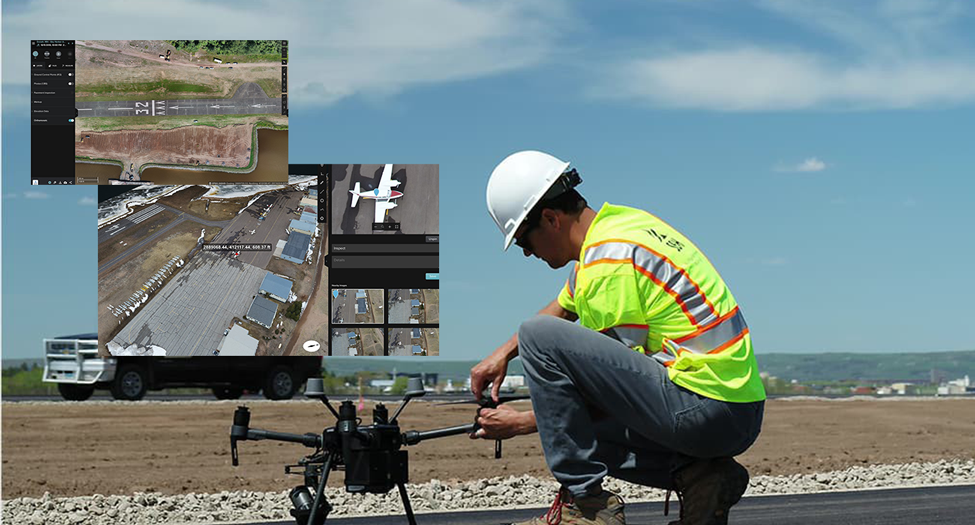
30 Mar Drone Mapping และ GIS ช่วยยกระดับการก่อสร้างรันเวย์สนามบินในสหรัฐอเมริกา Posted at 13:45h in Blog ... Read More
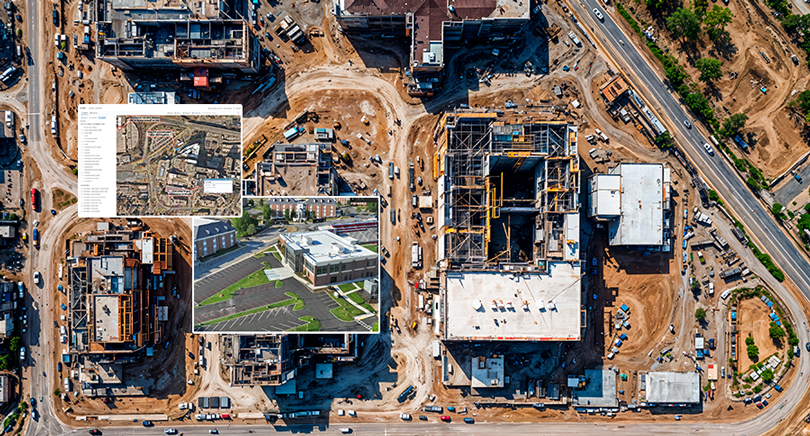
04 Feb Drone Mapping และ Site Scan for ArcGIS เปลี่ยนข้อมูลโดรนและ Imagery ให้เป็นการตัดสินใจที่แม่นยำด้วย GIS Posted at 12:09h in Blog ... Read More