


Logo Logo Logo Logo Logo
  • EN
    • TH
    • LA
    • KH
  • Products
    • Capabilities
      • Location Intelligence
      • Digital Twin
      • GeoAI
      • Cloud GIS
      • Mapping
      • Field Operations
      • Spatial & Data Science
      • Imagery and Remote Sensing
      • Real-Time Visualization & Analytics
      • 3D Visualization & Analytics
      • Data Management
    • ArcGIS
      • What is GIS?
      • About ArcGIS
      • ArcGIS Online
      • ArcGIS Pro
      • ArcGIS Enterprise
      • ArcGIS Platform
      • ArcGIS Apps
      • ArcGIS Reality
    • Geo-enabled Systems
      • ArcGIS Business Analyst
      • ArcGIS Hub
      • ArcGIS GeoBIM
      • ArcGIS Urban
      • ArcGIS Indoors
    • Esri Thailand Store
  • Solutions
    • Industries
      • Agriculture
      • Architecture, Engineering & Construction
      • Banking
      • Climate Action
      • Defense
      • Education
      • Electric
    • Industries
      • Government
      • Health and Human Services
      • Insurance
      • Manufacturing
      • Natural Resources
      • Public Safety
      • Real Estate
    • Industries
      • Retail
      • Smart City
      • Sustainable Development
      • Transportation
      • Telecommunications
      • Water
  • Support & Services
    • Esri Services
    • Utility Network Information Management
    • Documentation
    • Training
    • Product Management
    • Maintenance Program
    • ArcGIS Online Health Dashboards
    • Scope of Support
    • ArcGIS Trust Center
    • Premium Support Services
    • My Esri
    • Esri Support Site
  • News & Events
    • Esri Thailand Blog
    • Esri Thailand News
    • WhereNext Magazine
  • About
    • Esri’s Open Vision
    • About Esri Thailand
    • Contact Us
    • Geographic Approach
  • EN
    • TH
    • LA
    • KH
  • Products

    • Capabilities
      • Location Intelligence
      • Digital Twin
      • GeoAI
      • Cloud GIS
      • Mapping
      • Field Operations
      • Spatial & Data Science
      • Imagery and Remote Sensing
      • Real-Time Visualization & Analytics
      • 3D Visualization & Analytics
      • Data Management
    • ArcGIS

      • What is GIS?
      • About ArcGIS
      • ArcGIS Online
      • ArcGIS Pro
      • ArcGIS Enterprise
      • ArcGIS Platform
      • ArcGIS Apps
      • ArcGIS Reality
    • Geo-enabled Systems

      • ArcGIS Business Analyst
      • ArcGIS Hub
      • ArcGIS GeoBIM
      • ArcGIS Urban
      • ArcGIS Indoors
    • Esri Thailand Store
  • Solutions

    • Industries

      • Agriculture
      • Architecture, Engineering & Construction
      • Banking
      • Climate Action
      • Defense
      • Education
      • Electric
    • Industries

      • Government
      • Health and Human Services
      • Insurance
      • Manufacturing
      • Natural Resources
      • Public Safety
      • Real Estate
    • Industries

      • Retail
      • Smart City
      • Sustainable Development
      • Transportation
      • Telecommunications
      • Water
  • Support & Services

    • Esri Services
    • Utility Network Information Management
    • Documentation
    • Training
    • Product Management
    • Maintenance Program
    • ArcGIS Online Health Dashboards
    • Scope of Support
    • ArcGIS Trust Center
    • Premium Support Services
    • My Esri
    • Esri Support Site
  • News & Events

    • Esri Thailand Blog
    • Esri Thailand News
    • WhereNext Magazine
  • About

    • Esri’s Open Vision
    • About Esri Thailand
    • Contact Us
    • Geographic Approach
  • EN
    • TH
    • LA
    • KH
Search:
  • 03Aug

    How did ArcGIS help build a traceability system for Bunge’s palm oil supply chain

    Blog / Blog
    ArcGIS Supply Chain Traceability ช่วย Bunge ตรวจสอบย้อนกลับห่วงโซ่อุปทานปาล์มน้ำมันด้วยข้อมูลเชิงพื้นที่
Access to Location Data—A Key for Commercial Real Estate Success

Success in the commercial real...

04 April, 2023

White House Portal Helps Communities Assess Exposure to Climate Hazards

Finding common ground on our...

14 March, 2023

Case Study: Next Generation IoT Mobileye Automobiles and Smart City Initiatives

It is estimated that a...

01 March, 2023

6 Case Studies on Digital Twins

Digital twins are virtual representations...

21 February, 2023
Interconnecting GIS and Digital Twins

A modern GIS is a...

31 January, 2023
The Power of Location and the Internet of Things (IoT)

The Internet of Things (IoT),...

18 January, 2023

ArcGIS—The Foundation for Digital Twins

A modern GIS is a...

04 January, 2023
How Smart Cities Use IoT to Drive Innovation

Many local and state governments...

13 December, 2022
What Is a Digital Twin

Industry and government organizations are...

30 November, 2022
Behavior Prediction in the Retail Industry

In the retail industry, product...

16 November, 2022
Predicting Traffic Patterns and Preventing Traffic Accidents

Anyone who’s attended a large...

02 November, 2022

Bringing a Stalled California City to Life: How 3D Models Move It Forward

By: Judy Fung At a crucible...

19 October, 2022

Future Impacts of GeoAI on Mapping

By: Steve Snow We are now...

04 October, 2022
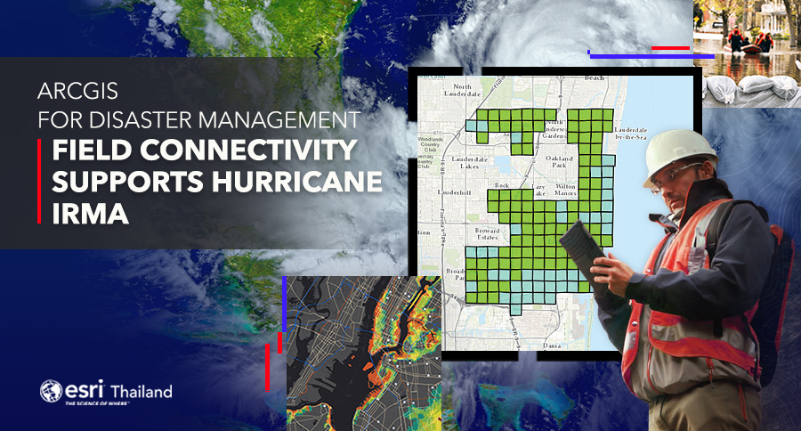
Field Connectivity Supports Hurricane Irma

Hurricane Irma was the first...

30 September, 2022
As Farms Move Indoors, Tech Follows

Author: Charlie Magruder and Matt...

14 September, 2022
Show more
Loading...

Contact us


    First Name - Last Name*

    Email*

    Mobile Phone*

    Company*

    Message*


    Subscribe to Esri Thailand news

    • Understanding GIS
      • What is GIS ?
      • Map We Love
      • ArcGIS Books
    • ArcGIS
      • ArcGIS
      • ArcGIS Online
      • ArcGIS Pro
      • ArcGIS Enterprise
      • ArcGIS Insights
      • ArcGIS Apps
    • Company Information
      • About Us
      • Contact us
      • Code of Conduct
      • Anti-Corruption Policy
    • Privacy & Terms
      • Privacy Policy
      • Terms of Service

    Esri Hotline : 02 678 0212

    Email : esrith.contact@cdg.co.th

    ©2023 ESRI (Thailand) Co., Ltd. All Rights Reserved.