

Natural Resources
Natural Resources
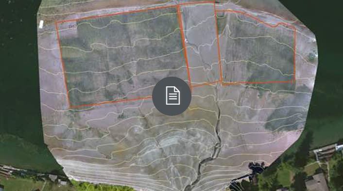
SUCCESS STORY
Tracing Each Oyster from Tide to Table
The largest shellfish producer in the United States, Taylor Shellfish Farms, uses ArcGIS software throughout its operations. Smart maps and spatial analysis help the company overcome challenges of ocean acidification, increase yield, track farm bed contents, collect and share data with easy-to-use field apps, and access real-time data on farm conditions.
Improve the efficiency of your production.
Whether you are managing the earth’s resources or your field and staff resources, ArcGIS software enables you to streamline workflows and maximize productivity. Spatial insights reveal new patterns and trends to help you make better-informed decisions that will help your organization thrive.

Create a central repository for all spatial data
Provide a complete platform to enable everyone in the organization to easily find, share, and analyze information.
Access a world of content
Access the foremost collection of global geographic information including imagery, boundaries, landscape, and demographic data layers.


Streamline daily workflows
Transform your daily operations; collect data in the field and share real-time information with your colleagues in the office.
Gain competitive insight
Advanced geospatial analytics allows you to uncover relationships in your data, empowering you to respond proactively rather than reactively.

Case Study

New map shows warming waters where coral reefs could be under threat
The Esri map distills NOAA’s data and displays regions that are facing both high heat stress, increasing the risk of coral bleaching.
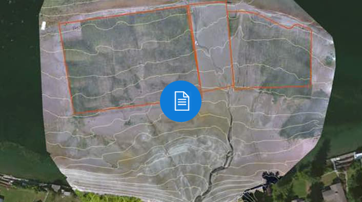
SUCCESS STORY
Tracing Each Oyster from Tide to Table
The largest shellfish producer in the United States, Taylor Shellfish Farms, uses ArcGIS software throughout its operations. Smart maps and spatial analysis help the company overcome challenges of ocean acidification, increase yield, track farm bed contents, collect and share data with easy-to-use field apps, and access real-time data on farm conditions.
Improve the efficiency of your production.
Whether you are managing the earth’s resources or your field and staff resources, ArcGIS software enables you to streamline workflows and maximize productivity. Spatial insights reveal new patterns and trends to help you make better-informed decisions that will help your organization thrive.
Create a central repository for all spatial data
Provide a complete platform to enable everyone in the organization to easily find, share, and analyze information.
Access a world of content
Access the foremost collection of global geographic information including imagery, boundaries, landscape, and demographic data layers.
Streamline daily workflows
Transform your daily operations; collect data in the field and share real-time information with your colleagues in the office.
Gain competitive insight
Advanced geospatial analytics allows you to uncover relationships in your data, empowering you to respond proactively rather than reactively.
Case Study
New map shows warming waters where coral reefs could be under threat
The Esri map distills NOAA’s data and displays regions that are facing both high heat stress, increasing the risk of coral bleaching.