ArcGIS Reality
ArcGIS Reality
Create accurate digital representations of the physical world
ArcGIS Reality
Create accurate digital representations of the physical world
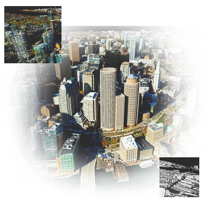
ArcGIS Reality is a suite of photogrammetry software products designed to enable reality capture workflows for sites, cities, and countries. Create a key component of your 3D digital twin with ArcGIS Reality. Turn drone and aerial imagery into visually stunning and highly accurate maps and 3D models. Interact with a digital world that shows places and situations as they truly are, layered with geospatial data that enriches reality with greater context.
Touring Cambridge with ArcGIS Reality
Learn how ArcGIS Reality Studio was used to create photo realistic 3D representations of Harvard University and the city of Cambridge, MA.
Enable your reality capture from input to output
Create foundational content
Transform sensor data into representations of the real world—detailed maps of construction sites, complex cityscape models, holistic regional mosaics, and beyond. Create multidimensional products like orthomosaics, terrain and elevation models, point clouds, and 3D meshes.
Process imagery at any scale
ArcGIS Reality offers flexible deployments that match your work environment and desired outputs. Access reality capture workflows that meet your needs, from quickly mapping new drone imagery while offline in the field to scaling the processing of large mosaics using the cloud.
Fully automated workflows
ArcGIS Reality provides a single system for reality capture. Manage, process, share, and extract information from your imagery in one place. Automate the production of geometrically accurate and photo-realistic textured results for entire cities and countries.
Photo-realistic 3D outputs
Create geometrically accurate 3D meshes that have photo- realistic texture and straight edges for accurate site, city, and infrastructure planning. Generate true orthophotos that are free of building lean and occlusions for easier change detection and building outline extraction.
Create an intuitive GIS experience
Provide visual context to your geospatial data, making it more approachable for geographic information system (GIS) experts and novices alike.
Find the software to fit your needs
Drone reality mapping
Drones enable on-demand and high-resolution reality mapping that offer more control over where and how often you capture and map your data. Use Esri’s end-to-end drone mapping tools—offline and in the cloud—to monitor a work site, map structures with high-resolution 3D modeling, or perform landscape measurements for project scoping.
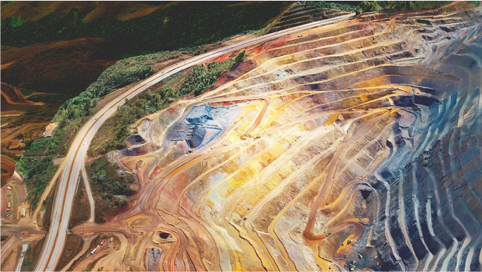
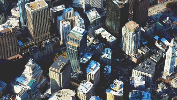
Photo-realistic results processed by ArcGIS Reality using imagery data provided by ©Bluesky Ltd.
ArcGIS Reality product suite
Find the photogrammetry software that fits the size of your projects and the sensors you work with.
ArcGIS Reality Studio
Explore this scalable, stand-alone application for citywide and countrywide reality mapping to create an important piece of 3D digital twins.
ArcGIS Reality for ArcGIS Pro
Use this extension to generate large-scale true DSMs, true orthos, DSM meshes, point clouds, and 3D meshes from satellite, aerial, and drone imagery.
Site Scan for ArcGIS
Process large volumes of drone imagery faster with cloud-based data processing and create 2D and 3D maps and models that you can quickly share across your organization.
ArcGIS Drone2Map
Process drone imagery on your desktop while offline or in the field. Turn recently collected drone images into 2D and 3D models, even without an internet connection.
ArcGIS Reality is a suite of photogrammetry software products designed to enable reality capture workflows for sites, cities, and countries. Create a key component of your 3D digital twin with ArcGIS Reality. Turn drone and aerial imagery into visually stunning and highly accurate maps and 3D models. Interact with a digital world that shows places and situations as they truly are, layered with geospatial data that enriches reality with greater context.
Touring Cambridge with ArcGIS Reality
Learn how ArcGIS Reality Studio was used to create photo realistic 3D representations of Harvard University and the city of Cambridge, MA.
Enable your reality capture from input to output
Create foundational content
Transform sensor data into representations of the real world— detailed maps of construction sites, complex cityscape models, holistic regional mosaics, and beyond. Create multidimensional products like orthomosaics, terrain and elevation models, point clouds, and 3D meshes.
Process imagery at any scale
ArcGIS Reality offers flexible deployments that match your work environment and desired outputs. Access reality capture workflows that meet your needs, from quickly mapping new drone imagery while offline in the field to scaling the processing of large mosaics using the cloud.
Fully automated workflows
ArcGIS Reality provides a single system for reality capture. Manage, process, share, and extract information from your imagery in one place. Automate the production of geometrically accurate and photo-realistic textured results for entire cities and countries.
Photo-realistic 3D outputs
Create geometrically accurate 3D meshes that have photo- realistic texture and straight edges for accurate site, city, and infrastructure planning. Generate true orthophotos that are free of building lean and occlusions for easier change detection and building outline extraction.
Create an intuitive GIS experience
Provide visual context to your geospatial data, making it more approachable for geographic information system (GIS) experts and novices alike.
Find the software to fit your needs
Drone reality mapping
Drones enable on-demand and high-resolution reality mapping that offer more control over where and how often you capture and map your data. Use Esri’s end-to-end drone mapping tools—offline and in the cloud—to monitor a work site, map structures with high-resolution 3D modeling, or perform landscape measurements for project scoping.

Photo-realistic results processed by ArcGIS Reality using imagery data provided by ©Bluesky Ltd.

