
Aligning people, process, and technology
Implementing a global mapping, reporting and analytics platform, BP enables everyone in their organization to leverage and share spatial data and information. Their one-stop shop for geospatial information has led to significant improvements in collaboration, enhanced subsurface workflows and improved exploration analytics and surveillance.
Strengthen every department
Geography influences all aspects of an oil and gas company’s work—from locating and extracting new resources to improving field management and ensuring HSE compliance. Advanced mapping and spatial analytics reveal deeper insight into relationships and patterns, answer complex questions, and help users make informed decisions.

A mapping and analytics platform for everyone
Give everyone in the organization access to the most accurate, consistent, and secure data. Make it easy to find, share, and analyze information.
Maps available everywhere
Access maps in familiar environments—such as Excel, PowerPoint, and online—to give data spatial context from the office or the field.

Everyday workflows transformed
Standardize and improve daily processes such as surveys, asset inspections, and operational surveillance; share the data anywhere, anytime.
Integration with existing systems
Enrich enterprise systems with location-based information to gain new business insight that improves analysis and decision-making.

EXPLORE A REAL-LIFE SCENARIO
An executive gets his first briefing of the day.
Before daylight, an oil and gas executive gets updated on projects and urgent issues. A simple customized portal delivers real-time business data to his personal device—anywhere, anytime. Precise and secure maps give him a worldwide view of situational performance.
EXPLORE A REAL-LIFE SCENARIO
The operations manager keeps up with production targets in West Texas.
He uses a live operations dashboard to view location-based KPIs including output volumes. With real-time data, the manager makes decisions on the fly to keep production flowing, while crews drill a new oil well
EXPLORE A REAL-LIFE SCENARIO
Northwest of San Antonio, a pipeline engineer examines an HCA.
Field crews have arrived at the high consequence area (HCA), while the pipeline engineer monitors the situation off-site. Looking at a real-time visualization of the network, he ensures ongoing work doesn’t impact resource allocation or delivery schedules.
EXPLORE A REAL-LIFE SCENARIO
Meanwhile in Charlotte, managers prepare for a storm.
Retail territory managers need to increase the supply of refined products to distribution centers ahead of an approaching weather front. An interactive map displaying a real-time weather feed helps them determine how to optimize the network to match anticipated demand.
EXPLORE A REAL-LIFE SCENARIO
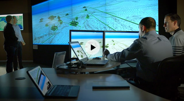
An HSE manager monitors the global risk portfolio.
The HSE manager monitors a globally distributed workforce and the status of multiple projects, including a tanker headed from the company’s Angola-based operations to a US refinery. She analyzes parameters to mitigate risk and ensure a safe arrival.
Case Study

Mitigating Risk by Visualizing Hidden Assets with Augmented Reality
Whiting’s One Call department is Using ArcGIS and the Argis Framework, the organization is able to visualize risk areas on-site, reducing analysis time and saving money

Data Management Solution Improves Operations in the Pipeline Industry
The GIS team’s Crestwood decided to merge databases into one and chose a new data management system to improve information management to help deliver superior results.

Sales group gains competitive advantage with GIS
Phillips 66 extends GIS use beyond geology, complementing its earth science with sales science.
Aligning people, process, and technology
Implementing a global mapping, reporting and analytics platform, BP enables everyone in their organization to leverage and share spatial data and information. Their one-stop shop for geospatial information has led to significant improvements in collaboration, enhanced subsurface workflows and improved exploration analytics and surveillance.
Strengthen every department
Geography influences all aspects of an oil and gas company’s work—from locating and extracting new resources to improving field management and ensuring HSE compliance. Advanced mapping and spatial analytics reveal deeper insight into relationships and patterns, answer complex questions, and help users make informed decisions.
A mapping and analytics platform for everyone
Give everyone in the organization access to the most accurate, consistent, and secure data. Make it easy to find, share, and analyze information.
Maps available everywhere
Access maps in familiar environments—such as Excel, PowerPoint, and online—to give data spatial context from the office or the field.
Everyday workflows transformed
Standardize and improve daily processes such as surveys, asset inspections, and operational surveillance; share the data anywhere, anytime.
Integration with existing systems
Enrich enterprise systems with location-based information to gain new business insight that improves analysis and decision-making.
EXPLORE A REAL-LIFE SCENARIO
An executive gets his first briefing of the day.
Before daylight, an oil and gas executive gets updated on projects and urgent issues. A simple customized portal delivers real-time business data to his personal device—anywhere, anytime. Precise and secure maps give him a worldwide view of situational performance.
EXPLORE A REAL-LIFE SCENARIO
The operations manager keeps up with production targets in West Texas.
He uses a live operations dashboard to view location-based KPIs including output volumes. With real-time data, the manager makes decisions on the fly to keep production flowing, while crews drill a new oil well
EXPLORE A REAL-LIFE SCENARIO
Northwest of San Antonio, a pipeline engineer examines an HCA.
Field crews have arrived at the high consequence area (HCA), while the pipeline engineer monitors the situation off-site. Looking at a real-time visualization of the network, he ensures ongoing work doesn’t impact resource allocation or delivery schedules.
EXPLORE A REAL-LIFE SCENARIO
Meanwhile in Charlotte, managers prepare for a storm.
Retail territory managers need to increase the supply of refined products to distribution centers ahead of an approaching weather front. An interactive map displaying a real-time weather feed helps them determine how to optimize the network to match anticipated demand.
EXPLORE A REAL-LIFE SCENARIO
An HSE manager monitors the global risk portfolio.
The HSE manager monitors a globally distributed workforce and the status of multiple projects, including a tanker headed from the company’s Angola-based operations to a US refinery. She analyzes parameters to mitigate risk and ensure a safe arrival.
Case Study
Mitigating Risk by Visualizing Hidden Assets with Augmented Reality
Whiting’s One Call department is Using ArcGIS and the Argis Framework, the organization is able to visualize risk areas on-site, reducing analysis time and saving money
Data Management Solution Improves Operations in the Pipeline Industry
The GIS team’s Crestwood decided to merge databases into one and chose a new data management system to improve information management to help deliver superior results.
Sales group gains competitive advantage with GIS
Phillips 66 extends GIS use beyond geology, complementing its earth science with sales science.