

20 Apr Data Management Solution Improves Operations in the Pipeline Industry
Crestwood Equity Partners LP (NYSE: CEQP) is a Texas-based midstream pipeline operator offering a range of services, including storage, transportation, marketing, and supply and logistics for natural gas, natural gas liquids, crude oil, and disposed water. Crestwood operates approximately 2,300 miles of pipeline onshore in the contiguous United States and provides all its services with a commitment to safety, compliance, and sustainability.
Maintaining and managing data is key to Crestwood’s successful day-to-day operations. But the company had disparate databases that were not connected, which made the task more difficult. The GIS team decided to merge databases into one and chose a new data management system to better edit and administer data, improving information management and helping Crestwood deliver superior results.
Challenge
Crestwood collects a variety of data supporting pipeline operations, including events along the pipeline, such as a road or water crossing, or details on pipeline locations. The data collected helps Crestwood manage environmental and population risks alongside pipeline installation and maintenance. With field offices around the United States, streamlining data management was a top priority to improve operational efficiency.
According to Craig Hawkins, GISP, manager of asset information and GIS for Crestwood, the company had three different databases, which made it difficult to manage data. As such, Crestwood sought comprehensive solutions to migrate all its databases into one and improve how data is managed.
Crestwood set out to implement a geodatabase data model that involved a spatial implementation of the pipeline open data standard (PODS)—a database designed for the management of pipeline data—and migrate all existing databases. However, the team also wanted a complementary tool that would work with PODS to edit data and improve information management.
“[Operators have] to choose how they store their data and what tools they want to use to interact with that data and report it throughout their organization. This primarily supports operational needs and meeting regulatory requirements,” says Hawkins. “So, we needed a way to make managing data more uniform.”
Solution
Crestwood chose ArcGIS Pipeline Referencing to complement PODS and help edit data. ArcGIS Pipeline Referencing is an extension to ArcGIS Pro and ArcGIS Enterprise that enables users to perform pipeline linear referencing data management. During the PODS database migration in November 2017, the GIS team simultaneously implemented ArcGIS Pipeline Referencing tools. 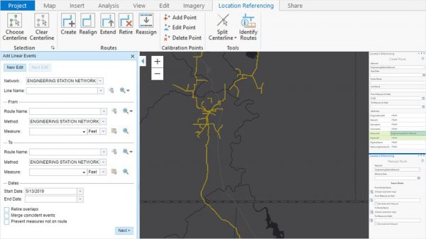
Heidi Shannon, supervisor of Pipeline As-Builts, Records, and Data at Crestwood, says, “After evaluating many pipeline data management software options in the market, we decided to implement ArcGIS Pipeline Referencing software. The intuitive interface and integration with our existing enterprise GIS platform allowed for a smooth implementation.”
The use of ArcGIS Pipeline Referencing made financial sense for Crestwood as well. Only one person out of Hawkins’s seven-person team is assigned as the main editor, so they were able to purchase just one license at an affordable price to suit their business needs.
ArcGIS Pipeline Referencing was also chosen for its flexibility. Hawkins explains that with other software providers, their data would be locked into a proprietary data model, but ArcGIS Pipeline Referencing enables the team to use any data model they choose. Hawkins enjoys the ability to work directly out of a geodatabase with ArcGIS Pipeline Referencing and says the tools are simple to use.
Hawkins and the GIS team worked closely with the Esri product team as well as a third-party vendor throughout the testing and implementation process for guidance and assistance, which took about six months total. The team tested ArcGIS Pipeline Referencing in a development environment, allowing them to test the workflows they wanted to use the software for before production.
Result
The use of ArcGIS Pipeline Referencing has improved data management for Crestwood. As data is now stored in one place, information can be easily shared with the entire organization.
“Some of the different workflows we had were not efficient. Simply having everything in one location has been tremendously helpful,” says Hawkins. “We have had efficiency gains across the board because we can easily manage that database and report out from one location instead of three.”
Crestwood liked a variety of features ArcGIS Pipeline Referencing offered, including the user-friendly interface and the ability to version.
“All the tools are pretty straightforward in the interface, and versioning allows us to keep track of our data governance,” says Hawkins. “We are able to make our edits in a version and then perform QA/QC before we post and reconcile to the database.” He adds that once the data is published with the software, it is available in their GIS environment quickly, including any map services. As such, web app users can consume the data almost immediately.
Hawkins also likes that ArcGIS Pipeline Referencing enables the team to maintain compliance with the Pipeline and Hazardous Materials Safety Administration (PHMSA), the regulatory body that oversees pipelines. The team can manage its ArcGIS suite without the help of a third-party vendor, as well as manage all records, data, and software. “From a regulatory standpoint, there’s something called traceable, verifiable, complete (TVC) requirements from PHMSA. The Esri software [including ArcGIS Pipeline Referencing] has allowed us to link records to our features in our geodatabase so they’re easily accessible in different formats like web apps, meeting this regulatory requirement,” says Hawkins.
Overall, Crestwood has seen significant improvement in information management with the use of Esri software. “Publishing our data through web apps has allowed different stakeholders to interact with information more efficiently. We have heard positive feedback from stakeholders throughout the company,” says Hawkins.
“ArcGIS Pipeline Referencing has proven to be a simple and effective tool, enabling our organization to efficiently edit and maintain our pipeline asset data.” Heidi ShannonCrestwood Equity Partners LP