
02 Jun ArcGIS behind the scenes of building collapse response — from data to action
Posted at 10:38h
in Blog
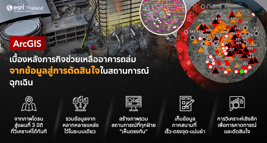
When GIS Becomes the Backbone of National Disaster Response: Turning Crisis into Coordinated Action
In times of emergency, information is the most critical resource. Geographic Information System (GIS) technology is no longer just a mapping tool—it’s a real-time engine that connects data, builds understanding, and drives decisions.
The recent building collapse at the Office of the Auditor General of Thailand is a powerful example of how GIS played a concrete role in supporting life-saving operations. GIS technology was applied across every aspect of the mission—from site surveying and spatial analysis to planning, coordination, and communication between field teams and command centers.
Beyond the Visible: Managing a Complex Emergency Zone
Emergency response in disaster zones is far more complex than it appears. The team had to navigate multiple invisible challenges, including:
- Dispersed data and delayed sharing between teams
- Lack of real-time situational awareness
- Ineffective communication with the public and related agencies
- Suboptimal allocation of limited resources
.
How GIS Helped Transform the Mission
GIS served as a central platform that integrated all layers of information—spatial data, drone imagery, field reports, and continuously evolving situational analysis—into a unified system.
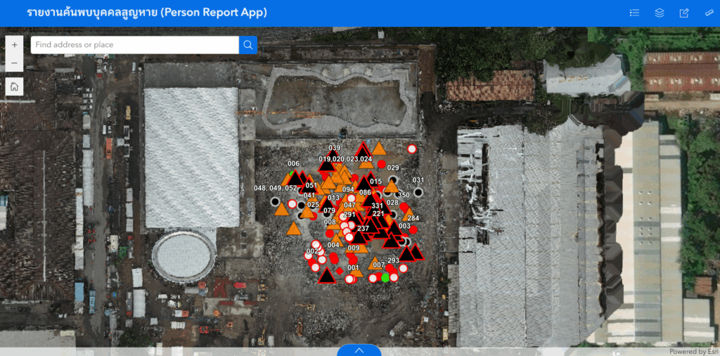
From Drone Images to Actionable 3D Maps
Drone imagery became more than just visual documentation. It was processed into high-resolution orthophotos and 3D models of the actual site, allowing engineers and analysts to assess structural integrity, identify hazardous zones, and plan rescue operations with precision—reducing risk for responders on the ground.
Fast, Accurate Field Data Collection
Field teams used mobile GIS tools to collect and report on-the-ground data—such as survivor locations, potential hazards, or structural damage—by pinpointing exact coordinates and attaching photos. This real-time reporting eliminated delays and minimized errors associated with traditional paper-based methods.
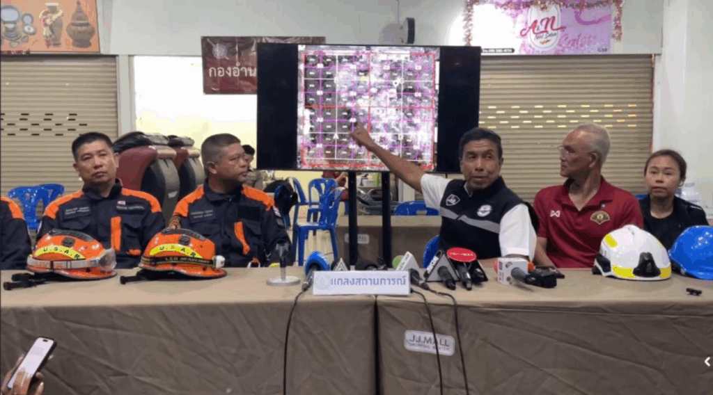
A Common Operating Picture for All Stakeholders
One of the mission’s key successes was enabling all stakeholders—from field responders to decision-makers—to view and operate on a single source of truth. A web-based interactive map compiled all relevant data into one interface, making collaboration more efficient and decision-making more timely.
Deeper Analysis for Smarter Forecasts and Decisions
GIS went beyond just telling responders “what is happening now.” With real-time data analysis, GIS helped anticipate what might happen next—modeling building volumes and heights, identifying unstable zones, and helping prioritize demolition, search paths, and safe access routes. It also optimized resource deployment, making operations more strategic and effective.
.
GIS: From Mapping Tool to Critical Decision Support System
This case shows that GIS is no longer reserved for planners in office settings. It has evolved into a decision support system that empowers crisis response efforts in meaningful ways:
- Structuring and streamlining data access
- Creating a shared operational picture for all teams
- Accelerating response and decision timelines
- Enhancing safety for field personnel
- Supporting public communication with accuracy and clarity
In high-pressure scenarios, having a system that integrates all sources of data and makes them accessible instantly can make a world of difference. GIS enables seamless connections between field data, aerial imagery, and spatial analysis—bridging the gap between data and action.
More than just maps, GIS reveals the full picture of dynamic situations in 3D, helping responders understand changes over time and answer crucial questions with confidence: Which areas are high-risk? Where should we act first? How should we allocate our resources? This is proof that GIS is not just an option in times of crisis—it’s a lifeline. Its value extends far beyond the immediate mission. It lays the groundwork for learning, preparation, and resilience in the face of future emergencies.
.