
20 Oct Apps Are the New Workflows Gulfport Energy Saves Time and Money with ArcGIS® Apps for Field Data Collection
Gulfport Energy is an independent oil and natural gas exploration and production company, headquartered in Oklahoma City, Oklahoma. To best serve its shareholders, the company is using technology to reduce costs while the market is tight and prepare for the inevitable rebound. Gulfport puts geographic information system (GIS) technology at the core of many critical activities and operations conducted in the office and the field.
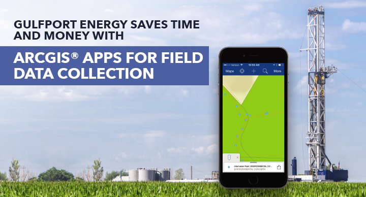
Recently, Gulfport Energy deployed ArcGIS® apps for the field. The company’s existing ArcGIS implementation included access to Collector for ArcGIS and Survey123 for ArcGIS at no additional cost, and use of the apps required minimal staff training. Previously, Gulfport had relied on third-party data collection services and applications, which were costly. Also, these came in paper forms, which made them difficult to share and led to inaccuracies.
Gulfport Energy used the Collector for ArcGIS app to identify suitable pad site locations as well as locating rights-of-way for above ground water pipelines. Collector—chosen for its map-centric workflow and ease of use for existing field crews—enables Gulfport to view and edit possible pad site locations to select the most suitable location. Collector helped to eliminate costly return trips to verify office analysis. Collector was also used in the waterline route planning to help secure rights-of-way while in the field. They now have more accurate data, have gained efficiencies in field workflows, and are providing up-to-date pad site and rights-of-way maps that can be easily viewed and shared across departments. Due to the success of Collector, Gulfport Energy turned to another ArcGIS app, Survey123, to create a workflow for the inspection of sump pumps across nearly 270 well-pad sites. The company wanted to monitor water quality using existing resources at each pad so that, where possible, freshwater discharge of stormwater runoff could take the place of trucking runoff for disposal. Having a surveystyle, form-centric data capture solution that’s easy for multi-phase (from construction to production) personnel to administer seemed a smart, efficient way to evaluate water quality and safeguard regulations compliance.
With the Survey123 for ArcGIS app, Gulfport Energy workers use smartphones, tablets, and laptops to collect the data needed to assess water quality in the field. Survey123 was selected because it works on the secure ArcGIS platform, provides multi-platform device support and seamless data transfer, and delivers real-time data to corporate stakeholders. Surveys can be customized to present questions with built-in logic so that additional questions will present depending on the answer given. Usability features, such as prompts and visual cues, are revealed where needed to ensure accuracy. The use of smartphones rather than paper-based forms makes data collection accurate and consistent from one worker to the next, and reduces the risk of survey data being lost or damaged.
“Without the use of this GIS technology, [we would not have] the realization of a first-year cost reduction of at least $2 million.”
—Mark James, GIS Manager, Gulfport Energy
Find out more about ArcGIS® Apps for Field Data Collection Click