


03 Aug How did ArcGIS help build a traceability system for Bunge’s palm oil supply chain
How did ArcGIS help build a traceability system for Bunge’s palm oil supply chain ?
Traceability is no longer just a requirement, but a key strategy for building a transparent and sustainable supply chain.
Organizations in the global agribusiness and food industry are focusing on increasing transparency in their sourcing processes, particularly the ability to trace the origin of raw materials and demonstrating environmental responsibility and sustainability.
Bunge, a global agribusiness and food company, has adopted ArcGIS to develop a traceability and monitoring platform for the palm oil supply chain. This system integrates data from multiple sources, including planting area data, supplier information, and satellite imagery, to efficiently track, analyze, and assess risks associated with the planting areas.
This approach enables Bunge to transform large amounts of data into actionable insights, build spatial understanding of sourcing processes, and prepare for ever-changing sustainability requirements.
Supply chain transparency and the challenges for modern businesses.
In the past, supply chain management may have focused primarily on the efficiency of production, sourcing, and delivery of goods. However, global market expectations have changed. Organizations are no longer evaluated solely on their products or financial performance, but must also demonstrate the origin of their raw materials, sourcing processes, and environmentally responsible business practices.
In particular, the palm oil industry, which involves numerous stakeholders from farmers and raw material collectors to producers and end consumers, makes it a significant challenge for global organizations to ensure that data from each segment can be linked, verified, and traceable.
Therefore, a traceability system is not just a tool for checking data retrospectively, but a crucial mechanism that helps organizations see the overall picture of the procurement process, assess risks, and ensure that operations comply with sustainability standards.
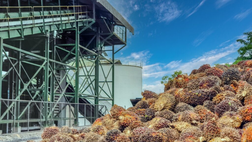
What is traceability , and why is it important for a supply chain?
Traceability, or a system for checking origins, is the ability to track the journey of raw materials or products from their source and production process to their final destination. This enables organizations to verify the source, assess risks, and manage their supply chain transparently.
For organizations with large supply chain networks, building an effective traceability system doesn’t mean collecting as much data as possible, but rather the ability to link data from multiple sources to create a clear understanding of what’s happening in each area.
In the agricultural sector, crucial data extends beyond supplier information; it also includes cultivated area, plot boundaries, land conditions, and environmental data. When this data is analyzed together, organizations can gain insight into spatial relationships and create Location Intelligence to support more effective management.
Bunge and the challenges of creating transparency in the palm oil supply chain.
Bunge emphasizes the importance of transparency in the palm oil supply chain, viewing traceability systems not merely as a response to existing requirements, but as a foundation that enables organizations to manage future changes.
One of the key challenges is managing large amounts of data from multiple sources in diverse formats, including data from suppliers, crop area data, and environmental data. If this data remains fragmented, tracing the origin of raw materials or assessing risks becomes difficult and time-consuming. Therefore, building a system that can link this data together is crucial for Bunge to gain a clearer overall view of its sourcing areas and processes.
ArcGIS transforms scattered data into a verifiable overview of the supply chain .
The core of a traceability system isn’t just about having a large amount of data, but about the ability to link that data together and make it ready for decision-making. ArcGIS enables Bunge to connect data from multiple sources on a single platform, including crop data, supplier information, and satellite imagery. This allows the team to analyze this data in a location-based context and gain a clearer overview of the procurement process.
Having data on a single platform simplifies data management, enhances auditability, and supports collaboration among relevant teams. All parties have access to standardized data and can use the same dataset for analysis and decision-making. Furthermore, integrating spatial data with business data allows organizations to see patterns, relationships, and potential risk factors in each area through the lens of Location Intelligence, supporting long-term management.
An effective traceability system is not limited to verifying the origin of raw materials; it must also enable organizations to continuously track changes, assess risks, and plan operations. By linking crop data, supplier information, and satellite imagery on ArcGIS, Bunge can visualize areas in a clearer context, monitoring the status of crops, examining changes in the land, and assessing factors that may contribute to environmental risks.
Integrating satellite imagery with spatial data enables organizations to efficiently monitor large areas and supports proactive risk management. This shifts the focus from retrospective investigations to providing organizations with data that allows for faster situational analysis and decision-making.
This approach reflects the role of Location Intelligence in transforming data from multiple sources into insightful data that supports the creation of more transparent and sustainable supply chains.

Spatial data helps create more transparent and sustainable supply chains.
Building an effective traceability system doesn’t depend solely on collecting large amounts of data, but also on the ability to link that data together and transform it into usable information for decision-making.
The Bunge case demonstrates that when crop area data, supplier data, and environmental data can be integrated on a single platform, organizations can gain a clearer overview of the procurement process. This supports data tracking, risk assessment, and collaboration among relevant agencies. In addition to improving traceability, the use of spatial data allows organizations to gain a deeper understanding of the context of each area, enabling them to identify issues requiring monitoring, analyze the situation, and develop appropriate operational strategies.
In an era where organizations must prioritize sustainability and responsible sourcing processes, having a data system that can continuously monitor, track, and analyze information is a crucial factor in building long-term trust with partners, customers, and stakeholders.
ArcGIS and Enhancing Supply Chain Traceability
ArcGIS is a geospatial platform that enables organizations to link spatial data with business data to create deeper understanding of areas, operational processes, and associated risks.
For organizations managing large supply chains, ArcGIS provides support ranging from data collection and management, spatial data analysis, to data visualization, enabling all parties to access and make decisions based on the same dataset.
Applying Location Intelligence to the supply chain allows organizations to not just “see” data, but to understand the context of that data, analyze the relationships between various factors, and use this information to make more effective decisions.
The case of Bunge demonstrates that a data-driven, spatially-based traceability system not only enables organizations to trace the origin of raw materials but also lays the foundation for a transparent, resilient, and adaptable supply chain management system ready for future changes.
.