
17 Jan ArcGIS—The Foundation for Digital Twins
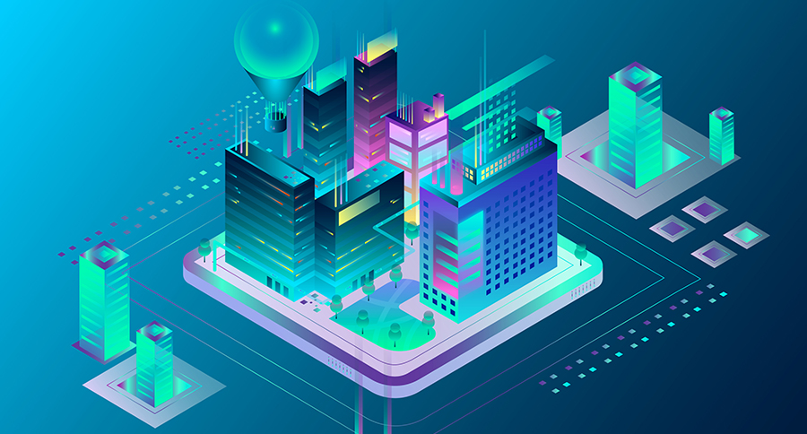
A modern GIS is a powerful tool used to represent a holistic digital twin in spatial context. Digital twins can address problems associated with understanding the historical events of an asset, monitoring current operational performance, and testing.
Any digital twin of a fixed asset or real-world system benefits directly from the inclusion of GIS data about the asset or system as well as its geographic context. Not only can GIS be used to create digital twins of natural and built environments, it also can be used to integrate many different digital representations of the real world.
GIS is the only technology that uses a simple key—location—to allow complex analysis of diverse data models and datasets. Geospatial digital twins, built with ArcGIS, can be explored on mobile devices, in a web browser, or through rich desktop applications from Esri and its partners.
GIS data also powers many simulations of real-world dynamics and behaviors. For simple analyses, such as investigating shadow impacts on a planned structure, 3D GIS provides dynamic, easy-to-use experiences in a web browser. For complex analyses, advanced geoprocessing workflows may be used to simulate changes in large utility networks and then to see those changes in a simple dashboard.
For decades, GIS has played a central role in helping customers model, analyze, and observe their assets and systems. New technologies, such as game engines and real-time data feeds, have added exciting possibilities to create richer interactive experiences for users to explore and analyze their assets and the world around them.
Esri is investing heavily in reality capture, building information modeling (BIM) integration, building systems integration, the analysis of Internet of Things (IoT) data, and related technologies and tools that will be used for creating the next great digital twins with ArcGIS.
Creating a Sustainable Future
At a global scale, organizations are looking to modernize their infrastructure to create a more sustainable future. Organizations must repair what is crumbling and ensure that it’s sustainable for the needs of today and resilient for the needs of tomorrow. This means protecting our energy, water, transportation, and telecommunications networks from many threats. It also means incorporating more renewable and sustainable energy sources and using collaborative ways of working with commerce, government, and communities.
Diverse industries are facing many new challenges:
- Energy utilities are looking to modernize their aging grids while also adapting to the changes imposed by large-scale Distributed Energy Resources (DERs).
- Transportation industries are striving to offset high carbon emissions through electrification and renewable energy.
- Water industries are introducing intelligent networks to understand and preserve the supply and quality of the world’s water resources.
- Telecommunication organizations are rapidly evolving to meet the demands of modern society, which is now as dependent on the communication infrastructure as it is on electricity and water.
- This integration and collaboration between organizations has redefined the importance of architecture, engineering, and construction (AEC) organizations and the role they play as they become an essential conduit to connect all these other organizations together through innovative and agile deployments of technology.
To reach this level of collaboration and resilience, organizations must be agile and able to adjust, accommodate, and meet changing business needs head-on. A massive amount of new construction in the coming decades will be driven by the ongoing march of urbanization, decarbonization, and digitization. Organizations need a strategy deployed with a geographic approach that can help energy, transportation, water, and telecommunications networks with creating and connecting the infrastructure for a sustainable future.
The infusion of intelligent GIS technology and the emergence of digital twins, applied with a geographic approach, make possible the integration of context awareness across all systems—built and natural.
Unleashing GIS Technology’s potential in every industries