
01 Jun How ArcGIS and Digital Twin Are Transforming One of Vietnam’s Most Important Port Systems
A case study on how 3D GIS and Digital Twin technologies are helping analyze, plan, and develop infrastructure for the Smart Port of the future.
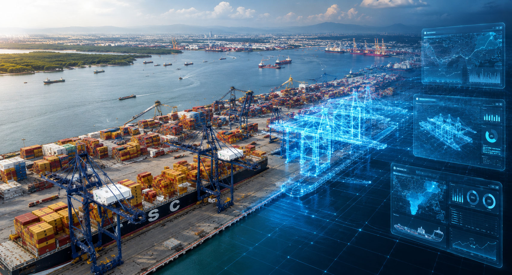
Today, major ports are no longer simply cargo handling facilities. They have become critical infrastructure that must support economic growth, expanding trade activities, and increasingly complex environmental challenges.
For Vietnam’s Cai Mep–Thi Vai Port system—one of the region’s most important maritime transportation hubs—long-term infrastructure planning and management require accurate, comprehensive data and a unified view of the entire system.
To address this need, the project team developed a 3D Living Digital Twin, using ArcGIS as the core platform for integrating, visualizing, and analyzing spatial data to support future port development and management decisions.
.
From Data to a Virtual Representation of the Port
A Digital Twin is a digital representation of real-world environments and infrastructure, bringing together data from multiple sources into a single, integrated view.
For this project, a detailed 3D model of the port area and its surrounding environment was created, enabling stakeholders to visualize information in its spatial context and better understand the relationships between various components within the port system.
More than just a 3D visualization, the Digital Twin serves as a powerful platform for analysis and planning, supporting both day-to-day operations and long-term infrastructure development.
.
Planning for the Future Through Scenario Simulation
One of the key advantages of a Digital Twin is its ability to help organizations evaluate and analyze different scenarios before making real-world decisions.
The project team can use the model to assess potential impacts from various factors, such as rising sea levels or future increases in port traffic and operational demand.
By visualizing potential impacts in advance, organizations can better prepare and make more informed decisions regarding infrastructure investment and long-term development strategies.
.
Supporting More Efficient Infrastructure Development
Beyond future scenario analysis, the Digital Twin also supports the planning and monitoring of infrastructure development projects within the port area.
Stakeholders can use the 3D model to better understand site conditions, evaluate different development options, and monitor construction progress more effectively.
Having information presented within its real-world spatial context also improves communication and collaboration among agencies and stakeholders, enabling more efficient decision-making processes.
.
ArcGIS and the Role of Digital Twin in Modern Infrastructure
The Cai Mep–Thi Vai Port case study demonstrates how ArcGIS can serve as a powerful platform for creating and managing Digital Twins for large-scale infrastructure projects.
By integrating spatial data with 3D models, organizations gain a comprehensive view of their assets and surrounding environments, allowing them to analyze, plan, and evaluate various scenarios more effectively.
As organizations around the world continue to pursue Smart Infrastructure initiatives and improve asset management practices, ArcGIS-powered Digital Twins are becoming an essential tool for connecting data with decision-making—helping organizations prepare for future growth and address emerging challenges in a more sustainable way.
.