05 Apr ArcGIS GeoBIM – An Introduction
ArcGIS GeoBIM: Connecting Projects in Context
Despite the narrowing of the gap between GIS and BIM over the last few years, Architecture, Engineering and Construction (AEC) firms and their clients are still battling with disparate data on multiple platforms, and are still struggling to provide a single authoritative view of project data to communicate project information easily and securely.
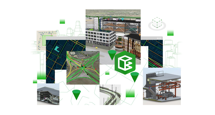
ArcGIS GeoBIM delivers an innovative, easy-to-use web-based experience for project teams to explore and collaborate on BIM projects and issues using data from multiple systems in a geospatial context.
What is ArcGIS GeoBIM?
ArcGIS GeoBIM enables the linking of projects and workflows by connecting ArcGIS with the Autodesk Construction Cloud and BIM 360.
Within a GeoBIM project, you can link georeferenced ArcGIS features with Autodesk records – meaning that it’s easier to access, visualize and query project documentation from multiple sources. GeoBIM also makes it easier to communicate and collaborate within a secure, web-based environment, which can be tailored to the needs of multiple stakeholders.
Who would use ArcGIS GeoBIM?
ArcGIS GeoBIM will benefit customers in any sector where organizations construct, manage, or renovate fixed physical assets – whether those are road or rail networks, utility networks, campuses, water facilities and more. However, there are three key customer types for whom ArcGIS GeoBIM can deliver new benefits from connected GIS & BIM.
AEC Executives: Whether it’s a CEO, a Vice President or a Design Principal, AEC Executives need visibility into the data and documents that their teams are managing so that they can measure progress, understand risks and costs, and communicate seamlessly with stakeholders. They also want to differentiate themselves from competitors by streamlining processes and providing better insight into projects for their clients. ArcGIS GeoBIM provides a single common experience to access project data. By leveraging ArcGIS and the Autodesk Construction Cloud in a web-based app, it’s possible to consolidate and visualize digital models, GIS data, supporting documentation and issues at both a single project and on a portfolio level.
GeoBIM allows AEC Executives to see all their project activity on a single map without the need for specialized desktop software. In addition to viewing up-to-date BIM and GIS data, they can connect to dashboards and tabular data that give them insight into how a project is progressing.
For example, issues can be mapped and tracked according to issue type, subtype and status. As team members collaborate on and resolve issues within the Autodesk Construction Cloud, that information is automatically visible to stakeholders within GeoBIM. ArcGIS GeoBIM also enables better and more seamless communication of project information with stakeholders. GeoBIM apps provide a secure and highly configurable way for AEC Executives to access views into a single project, or a portfolio of projects. As stakeholder needs change, apps can be tailored to provide different dashboards, different types of information, and different functionality, with the ability to securely control who can see apps and data.
AEC Project Managers: Often project managers find that their teams are spending time locating and recreating project information, converting data from one format to another, and building one-off, bespoke tools to provide visibility into project locations and status. These workflows are ineffective and inefficient, eating into budgets. Design Managers, Construction Managers and Project Managers are just some of the people who want to organize projects without reorganizing data, minimize data conversion and use out-of-the-box enterprise ready tools to provide tailored experiences for different team members and stakeholders.
ArcGIS GeoBIM links directly to BIM data stored in its native environment. ArcGIS features are linked to dynamic BIM datasets – meaning that when a construction sheet is updated, or a new model version is uploaded to the Autodesk Construction Cloud, that information is available at once. The need for data to be moved, duplicated or converted is greatly reduced, saving teams time and effort. ArcGIS GeoBIM also gives AEC Project Managers a highly configurable environment connected to the Autodesk Construction Cloud, which can be used to meet standards such as ISO 19650. It can also provide a scalable web experience that can be re-used on future projects, minimizing the risks and costs associated with one-off, in-house custom tools.
Owner /Operators: People who own and manage facilities, assets and capital projects often have the problem that their maintenance and management information is completely separate from design and construction documentation. They need an overview of all their current projects, and insight into their portfolio. They want asset and engineering documents at their fingertips, and they want to be able to share project information securely and easily within their organization’s departments. ArcGIS GeoBIM can be configured for a single project, or for a portfolio of assets, and can be easily accessed by project members and members of other departments without the need for specialized tools or training. Teams can find construction documents, models, and other asset information using a GeoBIM app that combines a web-based map with data in multiple systems. They can search their existing GIS features, find related linked datasets from their map experience, and view models within the Autodesk Construction Cloud, knowing that the latest versions of relevant content is being served directly through GeoBIM, using the Autodesk Forge Viewer.
Organizations can communicate directly through the Autodesk Common Data Environment, along with a geospatially enabled view that creates a truly connected experience, from planning, to design, to construction, to maintenance. This means that detailed digital records can be passed to the owner or operator, increasing their understanding of the built assets they now own, and empowering them to make better decisions for the future.
Summary
ArcGIS GeoBIM delivers an innovative, easy-to-use web-based experience for project teams to explore and collaborate on BIM projects and issues using data from multiple systems in a geospatial context. AEC teams and owners can work with linked data from multiple systems in configurable web apps that simplify communication and collaboration with teams and stakeholders. With GeoBIM, teams spend less time on file conversion, thus increasing access to reliable up-to-date data. GeoBIM enables secure access to project information, including BIM content, reality capture, documentation, and issues so that project teams can see active information for better decision making and collaboration.
Unleashing GIS Technology’s potential in every industries